The 1920 Svalbard Treaty Demilitarization Mandate
Technician Arne Solberg clamped a fresh copper lead onto the emergency transmitter at Isfjord Radio as heavy static cleared to reveal a sudden surge of coded Soviet radio traffic from the mining settlements across the fjord. He adjusted the iron tuning dials on the receiver, listening through his headphones to the steady exchange between Soviet cargo vessels and the Russian mining administration at Barentsburg. Those rapid transmissions highlighted the defenseless reality of the frozen northern territory. Norwegian sovereign administration over the demilitarized archipelago operated without permanent military garrisons or coastal defense batteries. The regional governor managed civil affairs across rugged islands larger than West Virginia using only a handful of police officers, a small wooden station house, and civilian communication relays. Solberg logged the anomalous radio frequencies into his paper ledger and telegraphed the raw intercept data directly to the Ministry of Foreign Affairs in Oslo.
Officials in Oslo spread the encrypted warning from Isfjord across conference tables where military planners and diplomats were already debating the total lack of defensive armor on the archipelago. Article 9 of the 1920 Svalbard Treaty strictly prohibited the construction of naval bases, fortifications, or military outposts on Spitsbergen and Bear Island. Negotiators wrote that restriction after the First World War to keep the strategic Arctic crossroads open to all nations while granting full sovereignty to Norway. That legal mandate prevented Norwegian leaders from sending warships, digging artillery positions, or building airbases to secure the territory against a surprise landing. Cabinet ministers knew that moving a single infantry company to Longyearbyen would prompt Moscow to accuse them of tearing up the international treaty. Foreign Minister Halvard Lange gathered the growing stack of surveillance reports and forwarded them to allied embassies in Washington and London to seek urgent diplomatic backing.
Analysts inside the Central Intelligence Agency in Washington studied the forwarded Norwegian reports and drafted a classified estimate titled ORE 25-50. They recognized that the legal ban on fortifications made Svalbard one of the most vulnerable targets along the entire northern perimeter of the Atlantic alliance. Soviet state coal companies maintained several thousand Russian workers in settlements like Barentsburg and Grumant, easily outnumbering the local Norwegian miners and administrators. The intelligence team concluded that Soviet naval infantry could seize the airfields and natural deep-water fjords of the archipelago within a few hours. Such a coup would give the Soviet military an unobstructed route for long-range bombers and submarines to threaten Atlantic shipping routes between North America and Europe. Analysts stamped the completed intelligence estimate for delivery to the White House and the Joint Chiefs of Staff to trigger high-level contingency planning.
Officers inside the Pentagon examined the distributed intelligence binder to determine how allied forces could defend an island chain possessing zero military installations. They realized that sending American soldiers directly to Spitsbergen would cause a diplomatic crisis by violating the demilitarization clause of the treaty. Planners pulled out maritime charts of the Norwegian Sea to calculate how quickly naval task forces could steam north from British bases during a shooting war. The logistical calculations showed that carrier planes would take days to arrive, leaving the islands completely unprotected against an initial Soviet assault. Defense leaders decided that deterrence in the Far North had to rely on rapid air strikes and naval sweeps launched from international waters rather than boots on the ground. General Omar Bradley and the Joint Chiefs of Staff approved operational guidelines ordering the Atlantic Command to war-game Arctic carrier strikes without establishing permanent bases on the demilitarized islands.
Arktikugol Mining Concessions and Soviet Arctic Footprint
Maps spread across planning tables at Atlantic Command showed that any Arctic strike route would fly straight into industrial territory controlled by the Soviet state trust Arktikugol. The Soviet state trust operated expansive coal mining concessions at Barentsburg, Grumant, and Pyramiden, sustaining a substantial civilian Soviet population that far outnumbered the Norwegian residents of the archipelago. Thousands of Russian miners, tunnel engineers, administrative clerks, and their families lived in these self-sufficient company towns complete with communal dining halls, heated brick dormitories, and cultural clubs. Heavy freighters from Murmansk and Arkhangelsk continually sailed into the fjords to deliver structural steel, fresh grain, and thousands of tons of timber to keep the underground mine shafts operating through the bitter polar winter. This continuous civilian maritime traffic provided Moscow with a legal cover under the treaty to maintain an unbroken logistical bridgehead right across the northern sea approaches to Scandinavia. Planners in Washington recognized that these crowded coal settlements created a severe political barrier because any American carrier raid against the islands would kill hundreds of noncombatants.
Analysts at Western naval intelligence began scrutinizing aerial photographs of those crowded mining works and quickly identified Soviet heavy machinery, port facilities, and terrain work at Barentsburg as potential dual-use infrastructure. Heavy bulldozers and steam-powered excavators carved out wide, level terraces along the steep shoreline that closely matched the dimensions required for temporary fighter dispersal strips. Concrete piers jutting into the deep waters of Gronfjorden featured heavy-lift cranes and high-capacity fuel bunkering lines capable of servicing ocean-going warships rather than simple coal colliers. Norwegian inspectors who visited Barentsburg reported seeing massive earthmoving projects where Soviet crews cut away frozen permafrost and graded flat gravel tracks under the guise of constructing surface haulage roads between mine shafts. Hydrographic soundings of the fjord confirmed that the deep underwater troughs leading directly to the Barentsburg docks offered sheltered submerged approaches where diesel-electric submarines could refuel and rearm beneath the protection of the surrounding coastal cliffs.
Submarines operating from those protected cliffside berths could slip directly into the open ocean to sever the transatlantic sea lanes connecting North America to Western Europe. Intelligence dossiers detailing these physical modifications traveled rapidly from allied naval headquarters to the desks of top cabinet officials in Oslo. Norwegian government ministers faced an agonizing legal dilemma because the treaty explicitly guaranteed Soviet citizens equal rights of access, residency, and economic exploitation across the islands. Prime Minister Einar Gerhardsen and Foreign Minister Halvard Lange could not legally evict the Russian miners or demand intrusive military inspections of the Arktikugol tunnels without provoking a dangerous confrontation with Moscow. Norwegian ambassadors repeatedly raised polite concerns through diplomatic channels, but Soviet officials dismissed every inquiry and insisted that every tractor, concrete pier, and radio mast served only the peaceful extraction of coal.
Ministers in Oslo realized that Moscow had completely closed the door to diplomatic reassurance, leaving the Norwegian government with no peaceful mechanism to halt the physical expansion of Arktikugol. Allied commanders in Washington and London responded to the diplomatic impasse by integrating the suspected Barentsburg docks and air facilities directly into their emergency war plans. Strategic planners at the Pentagon drew up covert naval patrol schedules to track Soviet merchant hulls hauling cargo between Murmansk and the mining ports. Norwegian maritime patrol craft received direct orders from Oslo to log every Soviet ship entering the fjords and photograph any heavy equipment unloaded onto the quays. General Bradley and the Joint Chiefs of Staff directed the Atlantic Fleet to stage mock carrier launches off the northern Norwegian coast to signal that any military conversion of the mining towns would be met with immediate naval airstrikes.
Submarine Reconnaissance and the Loss of USS Cochino
Submarines slipped beneath the icy swells behind those carrier task forces to collect the electronic and acoustic intelligence needed to track Soviet military reactions across the polar cap. The GUPPY II conversion submarine USS Cochino sank in the Norwegian Sea in August 1949 during a classified signals intelligence mission near Soviet waters after high polar seas wrecked its machinery. Equipped with a streamlined sail, high-capacity storage batteries, and sensitive radio intercept antennae, the vessel had prowled close to Murmansk to record Soviet military transmissions and map regional water acoustics. Violent Arctic gale winds and driving waves battered the hull, forcing seawater down the snorkel mast directly into the aft electrical compartments. Saltwater soaked into the lead-acid battery cells, generating deadly hydrogen gas and igniting a series of severe electrical fires that rapidly filled the crew compartments with toxic fumes.
Commander Rafael Benitez ordered his sailors onto the freezing exterior deck to escape the suffocating gas while damage control parties fought the fires with handheld extinguishers and water hoses. Crewmen braved freezing gale-force waves on the slippery casing for fourteen grueling hours as repeated hydrogen explosions tore through the battery rooms below. Torpedo retriever lines and heavy tow ropes connected the crippled submarine to USS Tusk, which drew alongside through mountainous seas to pull survivors off the pitching deck. Freezing seawater swept several sailors into the ocean during the chaotic transfer, claiming the lives of six crew members from Tusk and one civilian specialist. Benitez stepped off the hull onto a rescue raft just minutes before the flooded submarine slipped stern-first beneath the waves.
Wreckage vanishing into the two-mile-deep abyss triggered immediate shockwaves throughout the higher commands of the United States Navy and the State Department. The operational disaster underscored the high risk of covert hydrographic and acoustic surveillance along the Barents Sea approaches. Intelligence officers in Washington worried that Soviet patrol boats or reconnaissance aircraft might salvage floating debris or intercept distress traffic, revealing that an American warship had been eavesdropping along the edge of Soviet territorial seas. Navy leaders quickly created a cover story describing the voyage as an experimental cold-weather training cruise to protect the clandestine nature of the submarine signals program. Diplomatic cables shuttled between Washington, London, and Oslo to coordinate press statements and prevent Soviet diplomats from exploiting the loss to accuse the Atlantic alliance of aggressive espionage near Svalbard.
President Harry Truman and his national security team reviewed the classified loss report and recognized that Svalbard and the Barents Sea gap could not be monitored safely without provoking either deadly mechanical failures or an open war. Naval planners in the Pentagon revised Arctic operational orders, restricting future diesel submarine patrols to safer patrol lines further south in the Norwegian Sea until more reliable snorkel designs and advanced navigation gear reached the fleet. Admiral Forrest Sherman ordered technical modifications to battery ventilation systems and mandated stricter safety rules for electronic intelligence gathering in polar weather. Norwegian defense officials learned from the disaster that their northern maritime approaches were already a contested battleground where hidden surveillance operations could turn fatal without a single shot being fired. Military engineers in Washington and Oslo accelerated planning for coastal listening stations and island-based radar networks that could track Soviet northern movements without sending vulnerable submarines into frozen Arctic waters.
Naval Intelligence Assessments from OP-32
Cartographers inside the US Office of Naval Intelligence Division OP-32 compiled hydrographic surveys, bathymetric depth charts, and thermal current data to pinpoint where those radar posts and acoustic sensors had to focus. Division specialists mapped northern maritime transit corridors winding through the Arctic pack ice, detailing how deep, ice-free channels running past the western coast of Spitsbergen aided Soviet fleet egress into open waters. Warm Atlantic currents pushing northward kept these maritime gaps open even during the coldest winter months, giving Soviet Northern Fleet vessels leaving the Kola Peninsula a clear northern route around allied coastal defenses. OP-32 analysts plotted these open sea corridors across large nautical charts, demonstrating to naval commanders that Soviet warships could bypass northern Norway completely under cover of polar storms and winter darkness. Sonar soundings also revealed deep underwater trenches where Soviet submarines could run submerged at high speed without breaking the surface near Norwegian patrol boats. Senior planners in the Pentagon realized that Soviet commanders possessed an unobstructed ocean route straight into the North Atlantic, destroying the assumption that winter pack ice would lock the Red Navy inside the Barents Sea.
Analysts at OP-32 examined the narrow chokepoints along that northern ocean route and identified Bear Island as the decisive vulnerability in allied polar defense. The intelligence staff produced technical evaluations showing that a quick Soviet amphibious raid or paratrooper drop could capture the isolated, undefended Norwegian weather station on the island in less than an hour. OP-32 concluded that Soviet seizure of Bear Island would compromise early warning networks and flank allied maritime barriers in the Norwegian Sea. Radar installations and radio direction-finding stations placed on the high cliffs of Bear Island would let Soviet commanders track allied carrier forces while blinding Western air surveillance across the polar approaches. Allied acoustic listening posts along the seabed would also lose their local data links, leaving naval commanders unable to detect Soviet submarines slipping into the Atlantic. Soviet long-range strike bombers operating from bases near Murmansk could then fly south under the protection of this forward radar coverage, cutting directly through the maritime gaps between Greenland, Iceland, and the United Kingdom.
Admiral Forrest Sherman carried the OP-32 assessment directly to the White House and the National Security Council, warning President Harry Truman that a Soviet flanking maneuver around Bear Island would imperil transatlantic supply lines before allied armies could assemble in Europe. State Department officials under Secretary Dean Acheson reviewed the intelligence report and sharply disagreed with Pentagon generals over how to resolve the northern vulnerability. Acheson pointed out that sending American troops or building radar stations on Bear Island would violate Article 9 of the Svalbard Treaty, handing Moscow a legal pretext to occupy the entire archipelago. General Omar Bradley and the service chiefs countered that leaving the island undefended invited Soviet aggression, arguing that the treaty could not protect allied convoys from air and submarine attacks. Diplomats in Washington insisted that allied strategy had to rely on quiet security guarantees and private diplomatic pressure rather than visible military deployments that could panic the Scandinavian public.
Foreign Minister Halvard Lange received the classified American intelligence summary in Oslo and confronted a divided Norwegian cabinet worried about provoking Joseph Stalin. Norwegian cabinet ministers debated whether to request emergency naval guarantees from Washington or maintain their strict policy of refusing foreign bases on Norwegian territory during peacetime. Defense officials in Oslo knew that any visible American presence on Bear Island would provide Moscow with an excuse to demand joint control over the northern sea approaches. Lange authorized covert intelligence exchanges with the United States Navy while publicly reaffirming that Norway would manage its northern territories without stationing allied soldiers on Spitsbergen or Bear Island. American naval planners responded by revising their Arctic war directives, instructing Atlantic Fleet carriers to prepare deep offensive strikes into the Barents Sea to destroy Soviet invasion forces before they could seize Bear Island.
Intelligence Production of Estimate ORE 25-50
Carrier strike directives arrived at CIA headquarters alongside hydrographic charts from OP-32, compelling intelligence officers to examine the harsh operational realities of a shooting war in the Far North. Estimate ORE 25-50 incorporated OP-32 naval findings to assess whether Allied defense commitments could realistically protect the archipelago without violating peacetime treaty terms. Those naval hydrographic surveys showed that ice-free sea lanes gave Soviet warships an unobstructed path from Murmansk into the open Norwegian Sea. Demilitarization rules under Article 9 of the treaty prevented Norway or its Western allies from constructing coastal gun batteries, building airfields, or stationing defensive garrisons on the islands during peacetime. Analysts recognized that without pre-positioned troops or radar stations on site, allied security guarantees were virtually impossible to execute against a sudden surprise strike. Soviet naval transports and armed trawlers from the Kola Peninsula could cross the Barents Sea and put landing parties ashore across the archipelago in less than forty-eight hours.
Analysts at the Central Intelligence Agency disseminated intelligence estimate ORE 25-50 on June 26, 1950, evaluating the vulnerability of Spitsbergen to swift Soviet capture. Distribution of the document coincided with a massive international crisis as North Korean tanks surged across the 38th parallel only hours earlier, plunging Washington into round-the-clock emergency conferences. Senior national security officials read the Arctic assessment under intense geopolitical anxiety, fearing that the invasion in Asia and Soviet military maneuvers in the polar north were part of a coordinated global offensive. The estimate warned that Soviet forces could occupy Spitsbergen and Bear Island within hours, confronting the Atlantic alliance with an established fact before Western naval units could even clear port in the British Isles. Soviet coal miners and engineers already living in Barentsburg could secure landing strips and port docks from within, eliminating the need for a contested amphibious assault. President Harry Truman and his national security advisors confronted the bleak reality that allied carrier task forces could not retake Spitsbergen once Soviet troops occupied the settlements and installed anti-aircraft guns.
State Department diplomats under Secretary Dean Acheson met immediately with Norwegian officials to counter this vulnerability without giving Moscow an excuse to escalate. Halvard Lange and the Norwegian government insisted that deploying Western troops or building radar stations would violate the treaty and provoke an immediate Soviet military intervention. Acheson accepted that formal military garrisons on Spitsbergen were out of the question, leaving allied planners reliant on long-range naval deterrence and covert surveillance networks. Pentagon strategists abandoned plans for permanent island defenses, choosing instead to rely on mobile air power that could strike Soviet invasion routes from international waters. Naval commanders at Atlantic Fleet headquarters adjusted their operational war orders, assigning carrier task forces to maintain high-readiness patrol stations across the Norwegian Sea while intelligence officers established direct telegraph relays to monitor Soviet shipping movements out of Murmansk.
Strategic Choke Points and North Atlantic Sea Lanes
Teletype machines rattled across Atlantic Fleet command centers as watch officers translated the incoming Murmansk intercepts onto wall-sized nautical charts of the Norwegian Sea. Staff officers used grease pencils to track Red Navy destroyer squadrons and diesel submarines moving along the ice edge toward the deep Arctic trenches. Uncontested Soviet naval access to the Svalbard archipelago threatened to turn the northern flank of the Greenland, Iceland, and United Kingdom gap. Allied naval commanders had counted on anchoring their main defensive line across the narrow ocean passages between Scotland, Iceland, and Greenland to bottle up Soviet fleets in the polar north. Soviet warships sailing through open polar channels north of Svalbard could bypass those southern anti-submarine barriers completely and strike outward into the central Atlantic. Allied merchant convoys hauling American troops and heavy equipment across the ocean would then face sudden attacks from surface raiders emerging from the open polar ice.
Bombers stationed on improvised Arctic runways presented an even greater danger to those transatlantic shipping lanes than Soviet surface warships. Western planners recognized that Soviet maritime strike aviation operating from Spitsbergen could cut transatlantic supply lines supporting Western European defense. Long-range aircraft flying from gravel strips near Barentsburg or Longyearbyen could sweep down across the North Atlantic with anti-ship torpedoes, heavy bombs, and radar search gear. Cargo ships carrying industrial machinery, refined aviation fuel, and replacement artillery across the sea lanes would steam into range of continuous air attacks days before reaching British and French ports. Fighter cover from land bases in Scotland or Norway could not reach that far into the open ocean to shield the merchant freighters from high-altitude bomber formations. Escort carriers and anti-aircraft destroyers assigned to protect the convoys would exhaust their ammunition supplies battling off repeated polar air strikes before ever contacting enemy submarines.
Admiral Forrest Sherman brought these grim maritime supply projections before the Joint Chiefs of Staff to demand immediate changes to allied war plans. Sherman explained that the loss of Atlantic sea lanes would starve allied land armies in Europe of essential fuel and reinforcements within the first sixty days of general war. Diplomats in the State Department pushed back against proposals to send American garrison troops to Spitsbergen, warning that violating the treaty would give Soviet forces an instant legal justification to seize the airfields. Secretary of State Dean Acheson argued that NATO had to contain the polar choke point through naval air power and distant blockade patrols rather than risky territorial deployments. British and American naval planners agreed to shift additional strike carriers and long-range patrol planes to bases in northern Scotland and Iceland to guard against breakout attempts around the Svalbard flank.
Pilots at Scottish coastal airfields began running long-range search exercises across the cold waters between Jan Mayen and Bear Island to practice intercepting incoming strike bombers. Radar operators in patrol flying boats tracked practice targets through thick Arctic fog banks, testing how quickly sea-surveillance units could alert Atlantic convoy commanders to sudden fleet movements. Engineers at the British Admiralty drew up emergency mine-laying schedules to plug the deep-water channels running between Norway and Spitsbergen the moment fighting started. Norwegian liaison officers coordinated these covert barrier plans with allied commanders while keeping civilian cargo vessels on normal schedules to avoid alerting Soviet mining officials on the islands. American carrier task forces took up combat training positions in the storm-swept waters south of Iceland, positioning their flight decks to launch retaliatory air strikes against any Soviet air bases established on Spitsbergen.
Norwegian Peacetime Base Policy and Allied Diplomatic Friction
Steel flight decks pitching in the North Atlantic swell exposed the operational limits of carrier aviation, prompting allied generals to pressure Norway for secure airfields and fuel depots on dry land. Prime Minister Einar Gerhardsen and Foreign Minister Halvard Lange resisted this allied push because Norway entered NATO in 1949 with a self-imposed non-provocation doctrine that barred foreign military bases and atomic weapons on its sovereign territory during peacetime. Norwegian leaders crafted this base policy to reassure the Soviet Union across their shared Arctic land border and prevent the Scandinavian peninsula from becoming an active frontline. Soviet diplomats in Moscow had already warned Oslo before the North Atlantic Treaty was signed that hosting Western troops would turn Norway into an immediate military target. Lange delivered a formal diplomatic memorandum explaining that Norway would never grant allied access to domestic military facilities unless the country came under direct armed attack or faced an imminent threat of invasion. Norwegian parliamentarians in the Storting backed this policy by broad consensus, refusing to let foreign commanders dictate defense measures that might provoke Soviet cross-border retaliation.
Officers representing American and British military commands lobbied Oslo for forward contingency access in the Arctic, seeking pre-positioned fuel depots and emergency airfields along the northern transit routes. Western planners argued that allied bombers and radar picket ships needed northern installations to contest Soviet naval moves past Bear Island. British naval attaches insisted that Spitsbergen in particular required logistical preparations, warning that leaving the archipelago completely undefended invited Soviet troops to walk ashore unopposed. American and British military representatives encountered resolute Norwegian refusals to militarize Svalbard as defense officials in Oslo rejected every proposal to install combat gear or station allied personnel on the islands. Defense Minister Nils Langhelle informed the allied envoys that building fortifications or stockpiling military supplies on Spitsbergen would openly violate the treaty and destroy the delicate balance that kept northern Scandinavia stable. Lange warned his Western counterparts that giving NATO forces advance operational access to Svalbard would hand Moscow the perfect justification to send Red Army battalions into the Arktikugol mining settlements.
Ambassador Charles Ulrick Bay reported to Washington that Norwegian ministers would not yield, rejecting every compromise proposal for covert military preparations on the archipelago. Planners in London and Washington grew increasingly frustrated because their maritime war directives depended on knowing that Arctic bases could receive allied reinforcements on short notice. Royal Air Force officers asked for emergency permissions to land maritime patrol aircraft at civilian strips during sudden crises, but Norwegian air traffic authorities refused to authorize any pre-arranged military staging. Norwegian naval commanders insisted that their own small patrol cutters and coastal surveillance craft must remain the sole defenders of sovereign territorial waters during peacetime. Foreign Ministry officials in Oslo repeatedly reminded Western embassies that the base policy and the Svalbard demilitarization mandate protected Norway from being dragged into a superpower confrontation. State Department officials gradually accepted that pushing Oslo harder would only alienate a vital founding member of the alliance and fracture political unity across northern Europe.
Admiral Forrest Sherman and Atlantic Command planners adjusted their northern contingency blueprints to respect Norwegian sovereignty while searching for alternative ways to counter Soviet expansion. Joint Chiefs of Staff directives instructed the Atlantic Fleet to restrict future Arctic reinforcement plans to offshore carrier sweeps and long-range air patrols staging from Scotland and Iceland. Norwegian liaison officers established discreet communication links with allied naval commands to share weather forecasts, ice tracking reports, and civil shipping manifests without creating joint command structures on domestic soil. Technicians from the Norwegian Defense Research Establishment expanded their own domestic radar installations and coastal acoustic monitoring stations along the mainland shoreline to track Soviet movements independently. Norwegian construction crews mounted new surveillance antennas along the Finnmark coast, funneling electronic intercept logs into Oslo while keeping every foreign uniform and weapon system off Norwegian territory.
Cold War Legacies and High North Naval Doctrine
Signals intelligence logs from those mainland antennas confirmed to allied staff officers in Washington that Svalbard remained completely beyond their physical reach. Analysts at the Central Intelligence Agency and Pentagon planners reviewed the harsh operational findings of ORE 25-50, which demonstrated that no western garrison could survive a sudden Soviet attack without permanent fortifications, runways, and radar towers. Estimate ORE 25-50 compelled NATO to treat Svalbard as an unavoidable intelligence vacuum rather than a viable site for fortified military outposts. Peacetime treaty restrictions and Norwegian political red lines meant that allied commanders could not place radar masts, radio intercept vans, or armed infantry battalions on Spitsbergen without sparking a direct clash with Moscow. Allied naval headquarters accepted that Soviet military movements through the ice-free polar channels would unfold without immediate local warning, forcing western planners to redesign their entire northern strategy around deep oceanic distance.
Staff officers at the Pentagon redirected American naval power toward open water to work around this vast northern blind spot. The strategic impasse prompted the US Navy to rely on standoff carrier strike groups and acoustic monitoring arrays across the Norwegian Sea rather than Arctic ground garrisons. Fleet commanders positioned aircraft carriers hundreds of miles south of the ice edge, where strike jets could launch attacks against Soviet staging points without requiring physical bases on Norwegian soil. Heavy surface task forces practiced high-speed maneuvering in rough Arctic seas, staying far enough from the coast to avoid Soviet land-based bombers while remaining close enough to block any breakout into transatlantic shipping routes. Naval engineers worked simultaneously to design deep-water listening devices, seeking to track Soviet submarine movements through ocean currents rather than relying on lookouts on isolated Arctic islands.
Sonar technicians aboard specialized oceanographic ships spliced heavy hydrophone cables and lowered listening arrays into the deep seabed trenches of the Norwegian Sea. These underwater hydrophones formed the early testing grounds for long-range sound surveillance systems, picking up the low-frequency acoustic signatures of Soviet diesel and early nuclear submarine hulls. Shore stations situated in northern Scotland and Iceland recorded the underwater signals and forwarded the raw acoustic telemetry directly to allied anti-submarine command centers. Patrol aircraft crews flying long-range missions from Scottish bases dropped patterns of explosive sound charges and expendable sonobuoys to verify underwater targets detected by the seabed hydrophones. Watch officers in naval operations centers plotted the resulting submarine tracks along nautical grids, dispatching destroyer hunter-killer groups to intercept Soviet vessels as they cleared the ice-free corridors south of Spitsbergen.
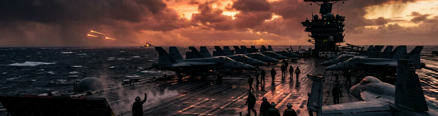
Aircraft carrier combat groups steamed into the Norwegian Sea during large-scale allied fleet maneuvers to test this blue-water containment network under realistic polar conditions. Flight deck crews cleared heavy sea ice from steam catapults and hoisted armor-piercing ordnance onto attack aircraft amid freezing spray and gale-force winds. Carrier pilots launched into heavy fog banks, flying mock strike runs against simulated enemy airfields along the northern maritime approaches before returning to land on rolling decks in the open ocean. Admiral Forrest Sherman and the Joint Chiefs of Staff formally incorporated these offshore carrier tactics and hydrophone monitoring lines into the permanent war plans of the Atlantic Command. Strike fleet commanders received standing operational orders to maintain combat readiness south of the polar pack ice, keeping allied firepower positioned to bottle up the Soviet Northern Fleet without placing a single combat boot on the frozen soil of Svalbard.