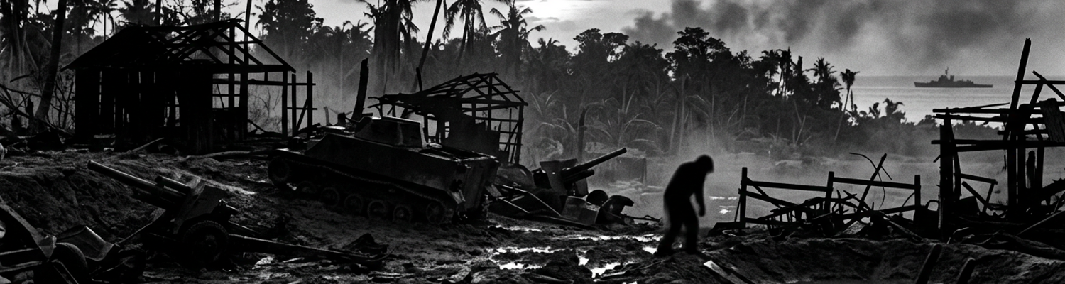

Interwar Naval Gunnery Doctrine and Theoretical Grid Planning
Admiral Harry Hill and the command staff of Task Force 52 had exactly thirteen days between the official securing of Saipan on July 9, 1944, and the scheduled J-Day amphibious assault on neighboring Tinian. Thirteen days existed to refit warships, replenish magazines, and finalize a comprehensive shore bombardment plan. The island defended 8,500 Japanese troops.
The planning window was mathematically impossible for the volume of ordnance required.
The clocks ran out before the ink on the fire support annexes could dry.
When examining the historical record, pre-1944 naval gunnery doctrine was rigidly engineered for a highly specific type of warfare. The Bureau of Ordnance training manuals operated under a strict set of assumptions regarding shore bombardment. Documents like Fleet Tactical Publication 167 were distributed to gunnery officers aboard Standard-type battleships like the USS Tennessee and USS California. Planners expected targets to consist primarily of isolated concrete fortifications. Interwar wargames at the Naval War College in Newport focused heavily on neutralizing solitary coastal defense batteries protecting strategic harbors. Ordnance engineers designed armor-piercing projectiles specifically to crack thick reinforced concrete bunkers. The Mark 1 mechanical fire control computers on these dreadnoughts were calibrated to calculate flat trajectories. High-velocity flight paths were needed to smash a single distinct pillbox on a barren shoreline. Gunnery crews trained repeatedly to achieve direct hits on these isolated hard targets. They used Mark 31 optical rangefinders that required clear lines of sight to a defined structural outline.
The entire mechanical apparatus of the Pacific Fleet was built to fight a heavily fortified static enemy outpost with thick concrete walls.
Nobody trained to shoot at a farm.
Archival evidence shows a deep disconnect between the theoretical grid planning executed in Washington and the physical environment of the Marianas. Standard grid targeting procedures relied on ballistics tables that failed to account for populated agrarian terrain. Tinian contained over 18,000 Japanese and Korean civilians. These laborers worked across thousands of acres of dense sugar cane fields managed by the Nanyo Kohatsu Kabushiki Kaisha. Civilian farmhouses broke the island into a massive patchwork of agricultural plots. Narrow dirt roads and low stone walls intersected the fields. Fire control officers applied their standard grid maps over this topography. They watched the mathematical models break down completely. Naval ballistics tables assumed either open water or flat unobstructed terrain. Engineers expected the blast radius of a high-capacity shell to spread evenly across the surface.
Planners divided the island into neat 1,000-yard squares.
The physical mechanics of the ordnance failed upon contact with the agricultural environment. Thick sugar cane stalks absorbed the high-velocity shrapnel meant for enemy infantry. Soft plowed agricultural dirt swallowed the point-detonating fuses on the fourteen-inch shells. Projectiles buried themselves deep underground before the firing mechanisms could trigger. Subterranean explosions threw up large geysers of soil. The surrounding crop cover remained completely intact. Forward observers looking through binoculars saw only continuous tracts of green sugar cane swaying in the wind. Staff officers on the flagship USS Cambria assigned specific grids to destroyers and cruisers based on pre-war coastal bombardment tables. Target Area 142-B near Ushi Point received heavy allocation. Gun directors input wind speed into the analog computers. They added powder temperature and range to hit these exact coordinates. The fourteen-inch guns of the bombardment force fired according to the book.
Shells landed exactly where the mathematical coordinates dictated.
High explosives saturated the target areas.
Japanese infantry simply moved a few hundred yards down the irrigation ditches into the next field. Base-detonating fuses designed to penetrate armor plate punched straight through the thin wooden roofs of the civilian farmhouses without exploding.
Task Force 52 Bombardment of Northern Tinian
A close review of operational logs indicates that Admiral Raymond Spruance ordered Task Force 52 to commence pre-invasion shore bombardments across northern Tinian during the second week of July 1944. Battleships of the bombardment group steamed into designated firing stations just off the western coast. The USS Colorado, USS Tennessee, and USS California anchored the line. Navigators plotted courses keeping the heavy dreadnoughts between 3,000 and 10,000 yards from the shoreline. Northern Tinian presented a specific topographical problem for the gunnery crews. The terrain around Ushi Point and Faibus San Hilo Point consisted of low limestone cliffs transitioning immediately into dense agricultural plots. Civilian tenant farmers managed these tracts. Fire Support commanders assigned distinct geographic zones to each vessel based on aerial reconnaissance photographs taken days prior. The USS Colorado took up positions to neutralize suspected Japanese artillery batteries hidden near the Ushi Point airfield. Crews aboard these interwar-era warships spent hours calibrating their analog Mark 1 fire control computers. They had to account for the prevailing trade winds sweeping across the Marianas.
Gun directors locked their optical rangefinders onto the northern cliff faces.
High-caliber battleship guns fired fourteen-inch high-explosive shells onto targeted island grid sectors. This systematic attempt aimed to obliterate the coastal defenses. Inside the heavily armored turrets of the USS Tennessee, sailors operated complex hydraulic hoists. They lifted 1,275-pound high-capacity projectiles from the deep lower magazines up to the gun houses. Gunners mates rammed these massive shells into the breeches of the 14-inch/50 caliber rifles. Hydraulic rammers shoved the heavy ordnance forward. The copper driving bands engaged the rifling grooves inside the barrels. Turret crews sealed the massive breech plugs and stepped back into the steel enclosures. Target area maps divided the northern agricultural zones into designated 1,000-yard squares. Fire control officers relayed specific X and Y coordinates to the turret captains down below.
The firing circuits closed.
The resulting overpressure from the fourteen-inch guns shattered the glass fixtures across the battleships superstructures.
Tons of steel arched over the coastline toward the farm sectors.
Archival evidence shows that the mechanical properties of these high-explosive munitions reacted poorly with the specific agricultural topography of northern Tinian. Ordnance engineers had designed the fourteen-inch high-capacity shells to detonate on contact with hard surfaces. This design maximized the dispersion of lethal shrapnel. Planners expected the point-detonating fuses to strike concrete bunkers or compacted coral roads. The targeted grid sectors instead consisted largely of deep soft volcanic soil recently plowed for sugar cane cultivation. Projectiles traveling at 2,700 feet per second plunged directly into the loose dirt. Firing pins inside the nose fuses experienced a microsecond delay. They pushed through the soft earth rather than striking a rigid barrier. This mechanical lag allowed the 1,275-pound shells to bury themselves completely before the primary explosive charges detonated.
Subterranean blasts created massive craters.
They failed to project fragmentation laterally across the Japanese defensive positions.
Task Force 52 continued to saturate the northern grid sectors with heavy ordnance throughout the mid-July bombardment schedule. Spotter planes flying off escort carriers radioed back damage assessments. The reports indicated that the high-caliber fire was merely rearranging the dirt. Entire salvos from the USS California vanished into the sugar cane fields near the northern airfields. Japanese infantry units belonging to the 50th Regiment simply sheltered inside deep irrigation trenches. Civilian laborers had constructed these ditches decades earlier. The battleships expended their finite magazine capacities. The analog computers on the ships accurately placed the shells exactly where the theoretical grid coordinates dictated. Every mathematical variable for range proved correct. Wind and powder temperature calculations were flawless. The fourteen-inch projectiles hit the designated agricultural squares precisely.
Unexploded ordnance accumulated rapidly in the soft soil of the Nanyo Kohatsu Kabushiki Kaisha farms.
Projectile Dispersion and Destruction of Tenant Sugar Ranches
A close review of operational logs indicates that the naval bombardment of northern Tinian suffered from severe uncorrected projectile dispersion between July 16 and July 23, 1944. Gunnery officers aboard Task Force 52 vessels relied on standard ballistics tables. These manuals assumed pristine barrel conditions and predictable atmospheric pressure. The 14-inch/50 caliber rifles on older battleships like the USS California had fired hundreds of rounds during the preceding Saipan campaign just weeks prior. Continuous friction from the copper driving bands on the 1,275-pound shells wore down the steel rifling grooves inside the gun tubes. This mechanical degradation reduced the tight seal around the projectiles. Superheated propellant gases escaped past the shells during the firing sequence inside the turrets. Muzzle velocities dropped unpredictably below the standard 2,700 feet per second required for accurate targeting. Gun directors situated in the elevated fire control towers failed to input these degraded velocity metrics into their Mark 1 analog computers.
The resulting trajectories fell completely outside the mathematical models.
Archival evidence shows how this mechanical oversight translated directly to the physical geography of the island. The USS California and heavy cruisers like the USS Louisville fired broadsides at suspected Japanese artillery positions near Mount Lasso. The spread of the falling shot widened drastically. Standard battleship salvos fired at a range of 10,000 yards were expected to cluster within a tight 200-yard impact zone. Worn gun barrels caused the heavy fourteen-inch and eight-inch projectiles to scatter across areas exceeding 800 yards in width. Spotter planes flying at 3,000 feet above the island observed the heavy ordnance drifting far away from the specified military grid coordinates. Fire control personnel lacked clear visual reference points on the uniform green landscape to calculate optical corrections. Radio transmissions from the aircraft reported the misses. The analog systems on the ships continued to feed the same flawed elevation data to the turret captains below decks.
Uncorrected projectile dispersion scattered high-explosive shells into densely inhabited tenant farm plots.
When examining the historical record, the northern plain of Tinian contained vast networks of civilian sugar cane ranches. The Nanyo Kohatsu Kabushiki Kaisha operated these tracts. These agricultural homesteads occupied the flat terrain between Ushi Point and the western coastline. They were grouped tightly into Target Areas 144-C and 145-A. The properties consisted of interconnected wooden farmhouses. Equipment storage sheds and cane processing facilities sat on low limestone foundations. Thousands of Japanese, Korean, and Okinawan civilian laborers lived within these fragile structures during the pre-invasion bombardment phase. Scattered high-capacity shells plunged into these residential zones with massive kinetic force. Point-detonating fuses that had previously failed in the soft agricultural soil found hard targets in the compacted dirt courtyards. Stone property dividers triggered the firing pins.
Blast waves from the 1,275-pound shells instantly leveled the wooden structures.
Civilian sugar cane ranches and agricultural homesteads across the northern plain suffered widespread destruction. Shrapnel from the detonating ordnance sheared through the corrugated iron roofs. Thin timber walls of the tenant dwellings splintered. Errant fire patterns walked massive explosions systematically across the populated grid sectors. Base-detonating fuses designed to pierce warship armor punched through the roofs of the processing sheds. They exploded deep inside the living quarters. Entire families sheltering in shallow root cellars beneath the farmhouses were buried. The heavy projectiles struck the structures directly above them. Task Force 52 gunnery logs record the expenditure of over 3,000 major caliber rounds into these specific civilian farming districts over a period of five days.
The naval bombardment reduced the agricultural infrastructure to fragmented debris.
Civil Affairs Friction and Displaced Laborer Processing
When examining the historical record, the V Amphibious Corps Civil Affairs detachment encountered severe friction during the initial phases of the Tinian ground assault. Naval officers tasked with managing the displaced population expected a manageable trickle of non-combatants filtering through the front lines. Thousands of Korean, Japanese, and Okinawan farm workers employed by the Nanyo Kohatsu Kabushiki Kaisha instead flooded the western beachheads simultaneously. Planners had designated a narrow 400-yard strip of compacted coral near White Beach 1 as the primary civilian collection point. The sheer volume of fleeing agricultural laborers immediately overwhelmed this small geographic footprint. Processing protocols required civil affairs personnel to catalog each individual using standardized bilingual identification tags. They were ordered to physically separate civilian men of military age from suspected disguised combatants. Administrative procedures collapsed almost instantly as mechanical failures compounded the bottleneck.
Battery-operated portable megaphones used by interpreters to direct the crowds ingested fine volcanic dust and short-circuited.
Translators resorted to shouting instructions unassisted over the continuous roar of landing craft engines. Naval medical corpsmen exhausted their allocated stores of sulfanilamide powder within the first three hours. Iodine swabs and morphine syrettes ran out shortly after establishing the forward triage tents. The intake queues deteriorated into densely packed masses of terrified civilians.
Archival evidence shows that ongoing Japanese artillery duels severely hampered all efforts to secure these fleeing non-combatants. The Japanese 50th Infantry Regiment and 56th Naval Guard Force maintained active firebases. These positions were concealed within the elevated limestone ridges of Mount Lasso. Enemy gunners operated Type 41 75mm mountain guns and Type 96 150mm howitzers. These weapons were pre-registered on the exact dirt approach routes the tenant farmers used to escape the northern sugar plantations. United States Marine artillery battalions deployed 105mm howitzer batteries along the captured shoreline. The 14th Marines executed rapid counter-battery missions against these mountain positions. High-explosive shells from both sides crisscrossed at low altitudes directly over the civilian transit zones located in grid sectors 144-C and 145-A. Marine counter-battery fire generated deafening overpressure shockwaves that panicked the captive agricultural workers. Japanese artillery crews periodically adjusted their elevation dials downward. They dropped 75mm point-detonating fragmentation rounds directly into the crowded beachhead staging areas. The incoming projectiles struck the exposed coral rock. Jagged fragments tore horizontally through the densely packed holding pens.
Airbursts showered the unprotected processing flats with razor-sharp steel splinters.
A close review of operational logs indicates that naval personnel struggled violently to relocate the exposed farm workers out of the active bombardment zones. Civil affairs officers abandoned the standardized intake paperwork entirely. Military police began physically forcing groups of panicked civilians into shallow defilades. Anti-tank ditches and natural limestone sinkholes provided the only shield from the falling ordnance. Japanese spotters observing from the high ground directed concentrated mortar and howitzer barrages onto the main dirt roads. These routes led toward the projected internment camp at Churo. Sustained explosions cratered the primary evacuation corridors. Marine military police units lost all contact with the rear echelon command posts. Incoming shrapnel severed their field telephone wire lines. SCR-300 backpack radios failed to transmit clearly through the heavy electromagnetic interference. The naval gunfire support ships offshore generated massive radio static. Without secure communications, officers could not coordinate the arrival of two-and-a-half-ton transport trucks. These vehicles were required to haul the non-combatants away from the artillery crossfire.
Hundreds of families remained pinned down in the open agricultural drainage ditches near Ushi Point.
Naval corpsmen crawled through the mud under active fire. They dragged bleeding agricultural workers into the limited cover provided by destroyed sugar cane processing sheds. Blood pooled in the deep tire ruts left by the amphibious tractors. Officers of the V Amphibious Corps faced an unsolvable spatial geometry problem. The beachhead perimeter lacked the physical depth necessary to shelter the thousands of displaced laborers pouring out of the smoking cane fields. Every square yard of secured terrain was already allocated for incoming ammunition dumps. Vehicle parks and casualty clearing stations consumed the remaining space. Civil affairs personnel were forced to hold the civilian population directly against the shoreline. The 14th Marines fired continuous artillery missions just fifty yards away.
Eardrums ruptured as the 105mm howitzers slammed rounds toward Mount Lasso.
Quartermaster Challenges Regarding Agricultural and Livestock Loss
A close review of operational logs indicates that the Nanyo Kohatsu Kabushiki Kaisha agricultural operations relied heavily on imported livestock. Pre-invasion aerial reconnaissance over Target Areas 144-C and 145-A cataloged extensive wooden livestock pens. These enclosures held thousands of draft horses. Dairy cows and Okinawan black pigs sustained the tenant farming population. The fourteen-inch high-explosive bombardments from Task Force 52 systematically erased this biological infrastructure. Marine supply battalions attached to the 4th Marine Division pushed inland from White Beach 1 on July 25, 1944. Supply officers expected to secure intact civilian food caches. They instead found a large-scale sanitation crisis. Frontline quartermasters struggled to handle thousands of dead livestock scattered across pulverized homesteads. Shrapnel from the naval artillery had shredded the animal enclosures. Blast overpressure ruptured the internal organs of the grazing herds instantly. Heavy explosive ordnance threw animal remains across the surviving stone property dividers. Carcasses lay rotting in the open sun across hundreds of acres of destroyed sugar cane fields. The Marianas summer heat pushed daytime temperatures above ninety degrees.
The decomposing animal mass created an immediate biological hazard for the advancing infantry.
Archival evidence shows that Marine supply personnel lacked the organic equipment to manage this volume of organic decay. Swarms of blowflies descended on the agricultural sectors near Ushi Point. Naval medical officers recorded rapid spikes in dysentery and dengue fever among the frontline riflemen. These troops were forced to dig foxholes near the bloated carcasses. Quartermaster officers requisitioned armored D7 bulldozers from the 18th Naval Construction Battalion. They executed emergency sanitation protocols. Seabee operators drove the heavy earthmoving equipment directly into the active combat zones. They pushed the dead livestock into deep limestone sinkholes. Steel bulldozer tracks frequently slipped. They threw their heavy drive sprockets while operating in the liquefied remains of the dairy herds. Mechanics exposed themselves to sniper fire to reattach the heavy steel treads in the middle of the contaminated farm plots. Operators poured hundreds of gallons of high-octane aviation fuel over the animal remains and ignited the pits.
Thick black smoke from the burning carcasses drifted across the northern plain.
The ash obscured the optical rangefinders of the Marine artillery spotters.
When examining the historical record, pre-invasion planners had calculated that the 18,000 displaced farm workers would sustain themselves on local agricultural yields. Civil affairs annexes assumed the capture of intact rice storehouses. Planners relied on the continuous harvesting of the island vegetable plots. The sustained naval gunfire support missions had completely inverted this mathematical model. Point-detonating shells ignited the dry sugar cane fields. The ensuing fires burned the crops down to the volcanic soil. White phosphorus rounds fired by 105mm artillery batteries incinerated the secondary vegetable gardens. Fourteen-inch projectiles penetrated the concrete foundations of the Nanyo Kohatsu Kabushiki Kaisha grain silos before detonating. High-explosive blasts scattered hundreds of tons of milled rice across the dirt roads. Ground troops advancing through the northern plain found the local food storage infrastructure reduced to smoldering craters. The destruction of agrarian resources forced naval logistics personnel to import full emergency rations for survivors.
Supply clerks at the beachhead abruptly rewrote their entire cargo manifest.
Landing Ship Tanks assigned to Service Squadron Ten received immediate orders. They diverted combat provisions directly to the civilian internment camps. Quartermasters stationed at the White Beach logistics dumps broke open wooden crates of 10-in-1 emergency rations. These supplies were originally allocated for Marine rifle companies. Logistics officers loaded two-and-a-half-ton transport trucks with thousands of cans of processed meat. Dehydrated eggs and hardtack biscuits filled the cargo beds. Convoys drove these imported military supplies up the pulverized dirt tracks toward the Churo civilian holding area. The heavy influx of non-combatants rapidly depleted the diverted combat stores. Supply ships anchored off the western coast of Saipan received emergency radio requisitions to load bulk rice onto shallow-draft landing craft. Navy coxswains navigated these heavily laden boats across the three-mile channel separating the two islands. Intermittent Japanese mortar fire splashed around the hulls. Beachmasters directed the incoming food shipments to designated unloading zones marked by colored canvas panels. Working parties comprised of unarmed naval personnel physically carried the fifty-pound sacks of imported grain through knee-deep surf.