
OpOrder 301-67 and Estuary Surveillance Objectives
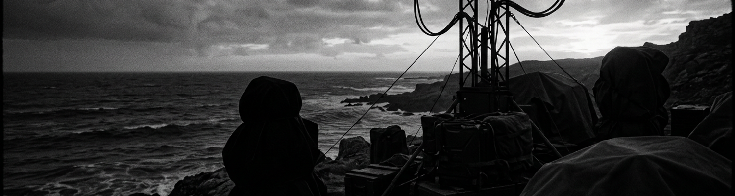
Lance Corporal James Vance sat in the damp sea breeze at the edge of the sand spit. He scraped salt corrosion off the terminal pins of an AN/PRC-25 radio handset with the tip of his bayonet. A fine spray from the breaking surf coated his hands in brine. This threatened to short out the battery housing before the sun dropped below the western treeline.
Five minutes later, the battalion radio net crackled with the official directive.
In May 1967, 2nd Battalion, 7th Marines issued OpOrder 301-67 from their tactical headquarters at Hill 55 south of Da Nang. Command staff drafted the document to establish rigid tactical control over the watery boundary where the Son Thu Bon River emptied into the South China Sea. Archival evidence shows that battalion commanders recognized these regional waterways were actively serving as unchecked supply corridors for local Viet Cong guerrillas and the 402nd Sapper Battalion.
Marine planners drafted the directive without consulting the regional United States Navy coastal patrol units already operating in the exact same littoral sector.
The operational plan designated grid coordinates AT 985 540 as the primary tactical baseline for Company E and Company F ground elements. This placed infantry riflemen directly along the shifting mudflats without specialized riverine craft.
Army supply officers in Saigon delayed the delivery of specialized riverine radar units for six weeks. They argued over transport priority.
A close review of operational logs indicates that the execution of riverine surveillance along the Cua Dai estuary degraded almost immediately due to severe hardware failures and service rivalries. Squads from Company G carrying M60 machine guns attempted to set up ambush positions in the brackish mangrove swamps around coordinate AT 992 528. Saltwater quickly corroded the gas cylinders of their crew-served weapons. The humid sea air rendered the electronic components of their early night vision devices entirely useless.
Marine radio operators could not contact Navy Patrol Craft Fast 103. Armed Viet Cong sampans slipped through the surf line. The Navy used VHF-FM channels that Marine ground radios could not secure without specialized cryptological fill cables.
Navy commanders refused to modify their operational cruising patterns to match the Marine battalion timetable. They cited direct orders from Seventh Fleet headquarters.
On the night of May 14, a clogged fuel injector stranded a Marine reconnaissance craft in the middle of the Cua Dai channel. Navy crews watched from two miles offshore. Fleet rules of engagement restricted them from entering uncharted river mouths without prior written authorization.
Tide tables left the infantry stranded in the silt.
Geographic Challenges of Quang Ngai Province
Operational priorities shifted south as 2nd Battalion, 7th Marines expanded interdiction sweeps across key coastal waterways in Quang Ngai Province. Command staff targeted the tidal networks surrounding the Song Tra Bong and Song Tra Khuc rivers. Insurgent supply networks moved arms through shallow inlets near grid coordinates BS 608 722 and BS 650 850.
Ground commanders assigned Company E riflemen and forward observers from the 3rd Battalion, 11th Marines to secure sandbar checkpoints along the estuary mouths. They attempted to deny waterborne transit to local VC cadres.
Shallow river channels forced the battalion to rely on light fiberglass craft and draft-limited landing vessels rather than heavy armor.
Fine silicon sand sucked up from riverbeds clogged the raw-water intake impellers on 26-foot LCVP engines within hours of deployment. Grit scoring cut into internal cooling pumps. This caused marine diesel engines to overheat. The boats were idling in mudflats. Drive shafts on outboard motors snapped under the friction of suspended silt. Patrols were stranded miles from their primary support base at the Quang Ngai airfield.
The physical geography of the Quang Ngai coastline exposed infantry units to constant tidal traps.
Battalion planners drew operational boundaries across the tidal mudflats of the Batangan Peninsula. They underestimated how rapidly three-foot tidal surges inundated observation posts along coordinate BS 672 815. Company H squads established night ambushes along the estuary banks. They found their positions submerged before midnight.
Radio operators carrying AN/PRC-25 sets had to hold equipment above their heads in brackish water. This prevented salt corrosion from destroying transceiver circuits. Battery housings flooded when pressure seals failed under prolonged submersion. Ground-to-air communications with CH-46 helicopters stationed offshore were cut.
Marine commanders refused to withdraw ground patrols during rising tides. They ordered squads to lash themselves to mangrove roots to maintain visual coverage over the water gaps. Inter-service friction spiked when Navy task force commanders declined to dispatch shallow-draft craft into uncharted inlets to extract flooded Marine squads. Navigational charts showed zero clearance at low tide. Ground troops remained stuck in waist-deep silt for hours. They were unable to move without drawing heavy mortar fire from fortified positions on the western river bank.
Heavy coastal fog and tropical squalls frequently obscured riverine sea lanes throughout the Quang Ngai operational area. This crippled visual and radar surveillance along the water routes. Thermal inversion layers rolling off the South China Sea between 0200 and 0700 hours routinely dropped ambient visibility below twenty yards across the Tra Khuc river mouth.
Sudden tropical squalls battered the coast with torrential rain. Heavy radar sea clutter blinded AN/TPS-21 ground search radars positioned along coordinate BS 681 834. Rainwater leaked through worn rubber gaskets on early-generation AN/PVS-2 Starlight night vision scopes. Internal high-voltage power transformers short-circuited. Image intensifier tubes burned out.
Crews aboard Navy Patrol Craft Fast 88 lost radar track of low-slung wooden sampans moving through the storm front. The sampans were loaded with 82mm mortar rounds. Battalion operations officers ordered 81mm mortar crews to launch unguided illumination shells every fifteen minutes into the fog to clear the river lanes. The high-altitude flares reflected off dense cloud banks. This blinded Marine sentries on the ground. The light painted their silhouettes clearly against the white haze.
Viet Cong gunners positioned near grid coordinate BS 664 829 exploited this lighting effect. They fired automatic weapons directly into exposed Marine positions. The rain hid their muzzle flashes.
Low-hanging stratus clouds blocked forward air controllers in O-1 Bird Dog aircraft from marking targets with white phosphorus rockets near grid BS 645 801. Marine A-4 Skyhawk pilots carrying 500-pound Mark 82 bombs were forced to abort close air support runs over narrow river channels. Fog obscured the treelines. Squads taking sniper fire from sandbars had to rely on uncorrected artillery fire from 105mm howitzers stationed at LZ Liz. These batteries registered three round errors due to heavy downpours altering shell ballistics.
Marine Ground Listening Post Deployment
In mid-May 1967, 2nd Battalion, 7th Marines established eight static ground listening posts along the low-lying Cua Dai shorelines. The objective was to detect night river crossings by local Viet Cong guerrillas. Squad leaders from Company H positioned two-man and three-man teams at five-hundred-yard intervals along the exposed sand spits surrounding grid coordinate AT 988 546.
Marine riflemen dug shallow fighting holes into wet silt just above the high-water mark. They covered their positions with drift timber and wet foliage to hide from coastal reconnaissance craft.
The static posts operated under total noise and light discipline between 1800 and 0600 hours. Sentries remained motionless for twelve-hour stretches while tracking watercraft movements across the main shipping channel.
Shifting mudbanks constantly eroded the listening post perimeters. Sentries had to rebuild their sandbag revetments twice per shift. Incoming tides washed away loose ground. Ground commanders assigned no direct infantry reserves to reinforce these isolated outposts. They relied instead on pre-arranged mortar target grids to suppress hostile forces if sentries came under attack.
Rising water flooded the listening trenches before midnight.
Each static ground post relied entirely on the tactical AN/PRC-25 radio set to maintain local field communications with company command posts located two miles inland. Radio operators carried the twenty-four-pound transceivers wrapped in plastic poncho liners. They attempted to protect the sensitive internal circuitry from high-humidity sea air and saltwater spray.
The dry-cell BA-386 batteries powering the units degraded rapidly in the tropical coastal climate. Output voltage dropped within four hours of continuous operation on the Cua Dai shorelines (NARA Record Group 338). Fine ocean salt coated the metal contacts of the H-138/U handset connectors. Intermittent signal shorts forced operators to scrape terminal pins clean with pocketknives in complete darkness.
The flexible AT-271 ten-foot steel whip antennas required for long-range transmission projected above the flat mangrove canopy. This drew small-arms fire from enemy sampans navigating grid coordinate AT 994 532. Marine signallers attempted to substitute low-profile wire antennas strung through brush. Signal strength dropped sharply when rain saturated the surrounding sand dunes.
Corrosion disabled three radio handsets during the first forty-eight hours of static deployment.
Communication breakdowns between the ground listening posts and naval support craft led to tactical gaps during night interdiction missions. On the night of May 18, 1967, a listening post manned by Company F sentries at grid AT 982 541 spotted three unlit wooden sampans. The boats were unloading mortar shells near the southern shore of the estuary.
The team attempted to transmit an immediate contact report over the AN/PRC-25 tactical net. The transceiver frequency drifted due to thermal changes inside the unventilated battery casing. Ground command received only static.
Fire authorization was delayed by twenty-two minutes. Staff officers attempted to clear the net. Marine battalion headquarters lacked direct radio links to U.S. Navy Patrol Craft Fast units stationed offshore. Calls for naval gunfire had to pass through an intermediary liaison center at Da Nang before reaching swift boat captains.
Navy crews received target coordinates for the Cua Dai sandbars. By that time, the enemy vessels had unloaded their cargo and vanished into the inland mangrove canals.
Humidity-induced transmitter failures left four listening posts completely out of radio contact during an enemy probe on May 21 near grid coordinate AT 989 539. Ground sentries fired red star clusters to alert nearby mortar crews. Heavy coastal mist obscured the signal flares from observation towers at Hill 55.
A post-operation inspection revealed heavy salt deposits inside the AN/PRC-25 channel selector switches. The salt physically jammed the tuning mechanisms on three separate radios. The transceivers were locked on a dead frequency.
Operation Market Time Swift Boat Integration
Offshore naval interdiction along the I Corps coastline relied on Task Force 115 craft patrolling the shallow approaches of Quang Ngai province.
U.S. Navy Market Time Swift Boats maintained continuous outer-concentric patrols across the open sea lanes just beyond the breaker line off the Cua Dai estuary. Operating from Coastal Surveillance Squadron One based out of Da Nang, these 50-foot aluminum-hulled Patrol Craft Fast vessels cruised grid coordinates AT 998 560 to BT 010 520. They maintained speed increments between eight and twelve knots.
The twin-screw vessels were powered by twin General Motors 12V71N marine diesel engines delivering 480 horsepower per shaft. They drew less than five feet of water. This allowed them to approach shallow shoals.
Crewmen stood watch behind dual-mounted .50 caliber Browning machine guns on the pilot house canopy. A stern-mounted 81mm mortar coupled to an underlying .50 caliber barrel provided direct fire support.
Operating so close to the surf line created severe mechanical strain. Fine silica sand suspended in the breaking waves sucked into the raw-water cooling intakes. The sand gouged the internal impellers. Engine head temperatures surged past 210 degrees Fahrenheit.
On May 24, 1967, PCF-78 suffered a total failure of its starboard cooling pump while idling eight hundred yards off the Cua Dai river bar. The crew had to drop anchor in six fathoms of water. Enemy gunners on the beach registered 82mm mortar impacts fifty yards short of its hull.
Executing real-time operational relays between Marine shore positions and Navy vessels required an inefficient four-tier radio chain across mismatched frequency bands. Infantry sentries from 2nd Battalion, 7th Marines watching grid coordinate AT 988 546 carried tactical AN/PRC-25 sets operating on low-band VHF-FM frequencies between 30 and 75 megahertz. Navy PCF crews monitored high-band VHF-AM and UHF channels between 225 and 400 megahertz.
Direct ship-to-shore voice transmission was impossible without dedicated hardware modifications.
Marine ground posts spotted unauthorized wooden sampans crossing the estuary line at midnight. Squad leaders had to transmit target coordinates back to the battalion tactical operations center at Hill 55. Operations officers at Hill 55 then contacted the Navy Coastal Coordination Center in Da Nang via landline telephone to request offshore interdiction. Navy staff personnel in Da Nang finally re-transmitted the fire request over secure UHF channels to PCF-104 idling off the coast.
This administrative circuit generated delays averaging fourteen minutes per engagement request.
On the night of May 27, nineteen unidentified watercraft moved through grid AT 992 538 during the operational delay. They unloaded six tons of rice and mortar ammunition into the bamboo thickets before PCF-104 received clearance to fire its 81mm mortar.
Command staff attempted to correct these tactical transmission gaps by placing Navy liaison officers directly inside the Marine regimental command bunker at Hoi An. This structural change created new layers of inter-service friction regarding rules of engagement and hydrographic safety thresholds.
Navy officers refused to order PCF crews into the narrow Cua Dai river channel at night. Hydrographic charts from 1965 failed to reflect recent sandbar migration caused by monsoon flooding.
Marine infantry commanders faced heavy sniper fire from sand spits near coordinate AT 985 541. They demanded that swift boats force their way three miles inland to provide direct canister rounds from their stern mortars.
PCF-82 attempted to cross the river bar on June 2 at mid-tide. The craft grounded on a submerged silt spit at grid AT 991 544. Silt jammed the main sea strainers. The port engine died. The vessel was stranded under small-arms fire from the southern shore.
Marine mortar crews from Company G had to expend forty-eight 81mm high-explosive shells to build a smoke screen. A shallow-draft LCM-6 landing craft towed the immobilized boat back out to deep water.
Tidal silt immobilized the fleet.
Incompatible Communications and Frequency Encryption
Voice contact between static Marine listening posts along the Cua Dai estuary and Navy Patrol Craft Fast crews degraded repeatedly throughout early June 1967. Squads from Company F and Company H occupying sand spits near grid coordinate AT 987 543 carried AN/PRC-25 transceivers tuned to low-band VHF-FM frequencies between 30 and 75 megahertz. Navy Swift Boats assigned to Task Force 115 patrolled two miles offshore using high-band VHF-AM and UHF shipboard systems operating between 225 and 400 megahertz.
Antenna elevation mismatched the flat coastal geography. Ground signals could not penetrate the thermal maritime boundary layer during high-humidity night watches. Ground signallers attempting to contact PCF-102 and PCF-104 when Viet Cong sampans crossed the estuary mouth at midnight received only hollow static.
Marine radio operators had to relay calls for emergency interdiction through the 2nd Battalion tactical operations center at Hill 55. The center relayed requests via landline to the Navy Coastal Coordination Center in Da Nang before reaching offshore boats.
On the night of June 4, this convoluted relay chain delayed target clearance by twenty-six minutes. Four armed supply craft crossed grid AT 991 538 and unloaded six tons of weapons into the mangrove tree lines.
Efforts to establish direct cryptographic links between ground riflemen and offshore naval patrols failed completely due to incompatible voice security hardware. Marine battalion signallers utilized the man-portable TSEC/KY-38 NESTOR encryption unit wired into their AN/PRC-25 backpacks. They relied on daily tactical keying material issued under Fleet Marine Force Pacific authority.
Navy Swift Boats mounted the vehicular TSEC/KY-8 or airborne TSEC/KY-28 NESTOR variants connected to shipboard transceivers. They used Seventh Fleet cryptographic fill codes.
Both services technically operated under the broader NESTOR equipment umbrella. Navy and Marine units did not share identical keying tapes or matching synchronization preambles.
A Marine radio operator switched his KY-38 into secure cipher mode to transmit target coordinates. The Navy KY-8 receiver aboard PCF-78 failed to achieve synchronization. It outputted only continuous digital hashing and scrambled mark-space noise. The cryptographic mismatched fill keys prevented ground sentries from warning naval crews about incoming fire targets without broadcasting unencrypted plain-text messages over open channels.
On June 8, 1967, this cryptological barrier caused an operational breakdown along the southern bank of the Cua Dai river mouth near coordinate AT 982 541. Sentries from 2nd Battalion, 7th Marines spotted two 402nd Sapper Battalion boats beaching demolition charges near an exposed Marine mortar pit.
The listening post operator keyed his KY-38 cipher box to call PCF-82 idling five hundred yards offshore. The Navy vessel KY-8 terminal rejected the cipher preamble and muted the audio stream.
The sentry bypassed the secure unit and broadcasted plain-text coordinates over an unencrypted 46.50 megahertz frequency. A Viet Cong signals intelligence monitoring post situated near grid AT 975 532 intercepted the clear-text transmission instantly.
The enemy sapper team abandoned their sampans. They retreated into dense brush and triggered three pre-rigged 82mm mortar barrages directly onto the Marine listening post. PCF-82 could not manual-tune its secondary FM receiver fast enough to locate the target.
A post-engagement audit conducted at Hill 55 revealed that Marine command staff lacked the security clearances to distribute Navy Seventh Fleet cryptographic fill tapes to frontline infantry squads. Ground commanders requested six additional TSEC/KY-8 vehicular units to install inside battalion landing craft. Army supply depots in Saigon assigned those units higher priority for armored cavalry units in III Corps.
Marine signallers attempted to hand-wire adapter cables between AN/PRC-25 sets and Navy auxiliary audio inputs. Humidity short-circuited the exposed pins and destroyed two internal transformer modules.
By mid-June, commanders instructed ground listening posts to abandon direct secure naval contact altogether. Squads had to rely strictly on unencrypted flare signals and manual mortar grid maps.
Degraded SIGINT Intercepts and Weather Interference
On the night of June 11, 1967, torrential monsoon squalls and dense coastal fog blanketed the Cua Dai estuary near grid coordinate AT 987 542. Ambient visibility dropped to under five yards across the tidal sandbars. Sentries from Company G, 2nd Battalion, 7th Marines could no longer track watercraft movement or observe signal flares along the river approaches.
Ground commanders at Hill 55 ordered frontline units to suspend visual reconnaissance. They were to rely entirely on signals intelligence provided by Sub-Unit 1 of the 1st Radio Battalion.
Operating from sandbagged huts near the beachhead, Marine SIGINT specialists deployed AN/PRD-1 radio direction finders and AN/TRR-24 intercept receivers. They monitored high-frequency tactical transmissions from the Viet Cong 31st Main Force Battalion.
Severe rain fade and coastal moisture degraded incoming radio signals. Direction-finding accuracy bearings inflated into broad ten-kilometer error ellipses. These yielded no targetable fixes. Heavy ocean spray shorted out unsealed vacuum tube circuits inside the PRD-1 loop antenna bases. Compass bearing indicators drifted thirty degrees off true north.
Tropical atmospheric disturbances across the Gulf of Tonkin severely disrupted radio wave propagation along the coastal lowlands. High levels of atmospheric static flooded the 2 to 12 megahertz frequency spectrum monitored by Marine SIGINT intercept teams.
At 0215 hours on June 12, radio operators at grid coordinate AT 978 535 attempted to intercept low-power Morse code bursts sent by an enemy coastal supply element. Ionospheric tilting caused by the storm front bounced ground-wave signals over Marine receiving antennas. This triggered severe signal fading every three minutes.
Intercept operators captured only fragmented code groups from the 15-watt bamboo-frame transmitters used by insurgent radio operators. Battalion staff officers at Hill 55 attempted to reconstruct these broken intercepts using manual grid overlays. Missing character groups prevented cryptanalysts from decoding call signs or operational objectives.
Analysts logged the partial intercepts as routine fishing watercraft traffic. Infantry outposts along grid AT 991 539 were left completely unaware of an incoming river crossing.
Encrypted relay equipment failed repeatedly under extreme humidity and electrical interference. Signallers relied on TSEC/KW-7 secure teletype cipher machines connected to AN/TRC-27 radio relay terminals to forward raw intercept data from the Cua Dai shorelines to the 1st Radio Battalion processing facility in Da Nang.
High-intensity lightning strikes over the Son Thu Bon River basin induced electrical surges along unshielded field wire lines connecting the intercept huts to the relay antennas. The voltage spikes burned out internal line-driver transistors and desynchronized stepping rotors inside the TSEC/KW-7 cryptographic units at 0340 hours.
Deprived of cryptographic synchronization, the teletype output degenerated into garbled noise. This blocked the transmission of time-sensitive threat warnings to ground commanders. Repair technicians spent forty-five minutes clearing jammed rotor assemblies and manually re-keying the cryptographic matrices with paper tape.
Signallers restored the encrypted relay at 0425 hours. Sappers from the 402nd Sapper Battalion had already slipped past Company E listening posts at grid AT 984 540 under cover of the storm.
Naval Gunfire Coordination and Service Jurisdictions
Coordinating heavy fire support along the Cua Dai estuary required negotiating overlapping operational boundaries established by two separate military branches. Ground units from 2nd Battalion, 7th Marines operated under the tactical direction of the III Marine Amphibious Force. This command asserted firing clearance authority over all land targets extending out to three nautical miles offshore near grid coordinate AT 995 545.
Offshore, Seventh Fleet surface warships like the destroyers USS Walke (DD-723) and USS Mansfield (DD-728) remained under the administrative command of Task Force 115.
Shore Fire Control Parties from the 1st Air Naval Gunfire Liaison Company carried radio packs to request 5-inch/38 caliber naval shells. They could not directly order offshore gunners to open fire. A designated Fire Support Coordination Line bisected the tidal approaches. This split legal authority between land commanders and fleet watch officers.
Every naval salvo directed at targets landward of the surf line required double clearance through both the Marine Tactical Operations Center at Hill 55 and the Navy Coastal Coordination Center in Da Nang. Map overlays maintained by Marine staff officers frequently conflicted with hydrographic boundaries charted on Seventh Fleet vessels. This caused jurisdictional spats over which service held clearance power over shallow sandbars.
Bureaucratic command friction routinely generated severe operational delays during high-intensity night engagements along the coast. On June 14, 1967, at 0115 hours, Viet Cong mortar crews positioned near grid coordinate AT 986 538 opened fire on Company G riflemen. They walked 82mm high-explosive rounds directly into the Marine perimeter.
Forward observers called for immediate 5-inch illumination and target suppression from the USS Walke. The destroyer was idling three miles off the Cua Dai river bar. Navy bridge watch officers refused to load the shells without explicit written authorization from the III Marine Amphibious Force Fire Support Coordination Center. They cited rules of engagement designed to prevent friendly fire with Market Time patrol boats.
Staff officers in Da Nang spent thirty-eight minutes arguing over radio channels about target coordinates and territorial clearance parameters. Marine casualties mounted on the sand dunes.
Naval liaison personnel released the fire mission at 0153 hours. The enemy mortar team had fired forty-two rounds, disassembled their bipods, and vanished into the mangrove canals. The initial salvo of 5-inch shells detonated in empty mud flats forty minutes after the first call for support.
Jurisdictional breakdowns left ground troops vulnerable along the Cua Dai estuary throughout the summer of 1967. Ground commanders submitted repeated formal complaints requesting direct firing authorization between battalion forward observers and offshore destroyers. Seventh Fleet headquarters rejected the proposals. They cited the requirement to protect friendly coastal watercraft from uncoordinated naval shells.
Tactical liaison officers attempted to streamline the approval sequence by installing direct telephone links between Hill 55 and naval fire control centers. Ocean moisture repeatedly corroded the wire terminals.
Marine riflemen along the Cua Dai sand spits had to rely on organic 81mm mortars. Offshore destroyers carrying heavy ordnance sat idle three miles out to sea.
On June 18, four separate naval gunfire requests were denied outright. Staff officers could not agree on sector boundaries before the targets slipped past grid coordinate AT 982 540.