
Amchitka Environmental Engineering Hazards
The drill rig shuddered. It was not from the subterranean work but from the shrieking wind tearing across Amchitka Island. A low-pressure system, typical for the Aleutians, had intensified without warning. A persistent drizzle transformed into a horizontal fusillade of freezing rain. Operational logs from the U.S. Atomic Energy Commission (AEC Document AEC-AM-68-1) detail how hydraulic lines on heavy cranes and earth-moving equipment began to stiffen. Their pressure dropped precipitously as the supercooled water instantly coated every exposed surface in a veneer of slick, heavy ice. Gears, meticulously lubricated for sub-zero temperatures, ground against this unnatural intrusion. The sound of stressed metal was a constant torment to the engineering crews.
The danger was not the cold alone. It was the relentless combination of wind and freezing precipitation. These katabatic winds, known locally as Williwaws, could plummet down from the island’s modest highlands at speeds approaching 140 miles per hour, creating hurricane-force gusts with no warning. Such conditions forced a complete halt to all external work. This delayed the tight schedules for the Long Shot, Milrow, and Cannikin nuclear tests. It turned simple tasks like walking from a barracks to a mess hall into a life-threatening ordeal.
Beneath the tundra, the ground was a profoundly unstable medium for the high-stakes engineering required. Amchitka is a volcanic island, part of the tectonically active Aleutian arc, a component of the Pacific Ring of Fire. This geological reality meant the island was in a near-constant state of low-level seismic activity, a fact that complicated every aspect of construction. For the engineers tasked with drilling the emplacement holes, some extending over a mile deep, this instability was a persistent menace. The ground was not solid bedrock in the conventional sense but a fractured, unpredictable composite.
A close review of operational logs indicates the greater challenge was the island’s permafrost. This layer of perennially frozen ground, shielded by a thin active layer of soil and tundra, was highly susceptible to disturbance. Heat from drilling operations, the construction of roads, and even vibrations from heavy machinery could initiate a thaw. As the ice-rich soil melted, it lost all load-bearing capacity, turning into a soupy, unstable slurry that could cause foundations to heave, sink, and fail. This process, known as thermokarst, could create unexpected sinkholes and slumps. It jeopardized the precise alignment of sensitive monitoring equipment and the structural integrity of the massive drill rigs. A 7.9 magnitude earthquake in 2014, decades after the tests, caused moderate damage and cracking to the earthen caps covering contaminated drilling mud pits, demonstrating the island’s perpetual geological volatility.
Compounding the subterranean hazards was the ingress of corrosive saltwater. The same powerful winds that threatened surface operations also carried a constant, aerosolized spray of saltwater far inland, coating every structure and piece of equipment. This created an aggressively corrosive environment that rapidly degraded unprotected metals. The more insidious problem, however, lay below ground. The test shafts for Long Shot, Milrow, and Cannikin were drilled deep into the island’s volcanic rock, thousands of feet below sea level. Despite extensive engineering efforts, the fractured nature of the rock and the immense hydrostatic pressure of the surrounding Bering Sea and Pacific Ocean meant that saltwater intrusion into the subterranean workings was a constant battle. This posed a dual threat. First, water had to be continually pumped out during construction and preparation phases, a major logistical and engineering drain. Second, the high salinity of the groundwater accelerated galvanic corrosion of the metal casings, support structures, and diagnostic equipment within the shafts. The interaction between different metals in a saltwater electrolyte created a natural battery that actively ate away at critical components. This threatened the integrity of the entire emplacement structure and raised concerns about the long-term containment of radioactive materials post-detonation. Modeling later showed that groundwater was the primary vehicle for potential radionuclide migration from the test cavities, making the initial battle against saltwater ingress a direct precursor to the long-term environmental monitoring challenge.
Subterranean Installation Deterioration
The moment the U.S. Atomic Energy Commission officially departed Amchitka in 1973, the complex subterranean structures built for the Long Shot, Milrow, and Cannikin tests began a slow, inexorable process of decay. Active maintenance halted. The primary containment relied on the integrity of the initial construction and the geologic stability of the surrounding rock. Department of Energy records indicate the primary method of securing the deep emplacement shafts, some descending nearly 6,000 feet, involved backfilling and the placement of concrete plugs. This solution was predicated on long-term stability that was never guaranteed. The immediate post-detonation environment within the blast cavities was one of extreme heat and pressure, which vitrified surrounding rock into a glass-like shell. Outside this immediate zone, the rock was heavily fractured and shocked. The long-term stewardship plan shifted to passive monitoring, abandoning any pretense of active intervention. This decision effectively turned the test sites into multi-generational experiments in geological containment, where structural integrity was left to contend with the island’s harsh realities. Shallow groundwater monitoring wells were plugged by 2001. Active groundwater analysis was discontinued, removing a key source of data on subsurface changes. The assumption was that the deep volcanic basalt and breccia would serve as a permanent sarcophagus. This left the steel-and-concrete plugs and casings, the last engineered barriers, to fend for themselves against forces they were not designed to indefinitely resist.
A powerful force acting against the integrity of the test shafts was the island’s location in one of the world’s most seismically active regions. Amchitka is a volcanic island on the Aleutian arc, a tectonic boundary characterized by intense and frequent earthquake activity. The Cannikin test itself registered a 7.0 on the Richter scale, causing massive rockfalls and altering the island’s surface. While Department of Energy analysis following a magnitude 7.9 earthquake in 2014 concluded that damage to the deep test cavities was unlikely, the event caused moderate cracking and slumping in the earthen caps covering surface drilling sites. This surface damage served as a physical manifestation of the stresses the entire island endures. The concern was not just a single, large-magnitude earthquake, but the cumulative effect of decades of near-constant, low-level tremors. Each seismic event, however small, would transmit shear and compressional waves through the rock, placing stress on the interface between the concrete plugs, the steel shaft liners, and the fractured host rock. Over time, this cyclic loading could induce micro-fracturing in the concrete, weaken the bond between materials, and potentially create or enlarge pathways for groundwater to penetrate deeper into the test zones. The U.S. Geological Survey continues to monitor seismic activity, with long-term plans including a potential alarm system for significant seismic events near the island that might warrant investigation of ground cracks.
The third mechanism of degradation was a relentless chemical and physical assault from the environment itself. The subarctic maritime climate, with its constant freeze-thaw cycles, posed a significant threat to the surface and near-surface concrete structures. Water penetrating into pores and cracks would freeze and expand, gradually spalling and weakening the material. Far below, a more insidious process was at work. The test shafts for all three detonations extended thousands of feet below sea level, where they were subject to immense hydrostatic pressure from saline groundwater. This saltwater is a highly effective electrolyte, accelerating the galvanic corrosion of the steel casings and any other metallic components left within the shafts. The interaction between different metals in this saltwater bath creates a natural battery that actively degrades the materials. Studies by Greenpeace in the 1990s reported finding americium-241, a decay product of plutonium, in freshwater samples, suggesting that groundwater was creating pathways for radionuclide migration. While Department of Energy modeling suggests very slow contaminant transport, the detection of any test-related isotopes in the surface environment indicates that the containment is not absolute. The combination of seismic stress creating new fissures and corrosive saltwater exploiting them presents the most probable long-term failure mechanism for the subterranean installations.
Imminent Underground Collapse Threat
The final act of the Cannikin test was not the detonation. It was a delayed, convulsive shudder of the earth 38 hours later. On November 8, 1971, the massive subterranean cavity created by the five-megaton explosion gave way. This was not an unexpected possibility. Engineers understood that the violent vaporization of thousands of tons of rock would create a void under pressures the surrounding geology could not indefinitely sustain. As the superheated gases within the cavity cooled, the internal pressure dropped. The weight of nearly 6,000 feet of overburdened rock became absolute. The roof of the blast cavity, a span of fractured and shocked granitic rock, failed. What followed was a progressive, upward collapse, a chain reaction of imploding rock and earth that propagated vertically through the geological strata. The entire process culminated when the collapse breached the surface.
The failure was geological, not engineered.
A close review of operational logs and post-test reports reveals the sheer scale of this structural failure. The ground above the Cannikin ground zero subsided, dropping precipitously to form a vast crater more than a mile wide and over 60 feet deep in some areas. Some reports state the depth reached 40 feet. This was not a slow, gentle slump but a catastrophic collapse that fundamentally altered the island’s topography. The violence of the initial blast, registering a 7.0 on the Richter scale, had already sent massive rockfalls and turf slides totaling over 35,000 square meters tumbling from the coastal bluffs. The subsequent collapse delivered the final blow. Eyewitness accounts and survey data show the surface physically dropping, creating a new, immediate landmark. The North and South Forks of White Alice Creek, a surface stream, vanished as their channels were swallowed by the new depression. For ten months, the creek simply flowed into the broken earth and disappeared, a stark visualization of the new subterranean fracture network created by the test and collapse.
There was no feasible technology to remove the radioactive material from the deep test cavities. The decommissioning strategy, therefore, was one of abandonment and passive containment. The plan relied on the vitrified rock shell created by the blast’s heat and the integrity of the surrounding geology to act as a permanent sarcophagus. Following the tests, the access shafts were backfilled and sealed. By 1973 the Atomic Energy Commission withdrew from the island, leaving the sites to contend with Amchitka’s intense seismic activity and corrosive maritime environment. All shallow monitoring wells were plugged by 2001, and active groundwater analysis was halted, a decision based on computer models suggesting very slow contaminant migration. The long-term plan shifted fully to periodic surface inspections and institutional controls, managed from afar by the Department of Energy’s Office of Legacy Management. This passive approach accepted that large-scale structural changes, like the Cannikin subsidence, were a component of the initial event, not a problem to be actively managed after the fact.
The localized signs of this failure were immediate and unambiguous. The most dramatic evidence was the formation of a new body of water, soon known as Cannikin Lake, as the subsidence crater filled with runoff and the captured waters of White Alice Creek. This lake, over a mile wide, became a permanent feature of the island’s landscape, a direct topographical marker of the underground void. Beyond the crater itself, the ground was riddled with new cracks and faults. A 2014 earthquake measuring 7.9 in magnitude later caused slumping and prominent cracking in the earthen caps covering surface drilling mud pits at the Long Shot site and others, demonstrating the ongoing volatility of the island’s surface when subjected to seismic stress. While Department of Energy analysis concluded this later quake likely did not damage the deep test cavities, the visible surface damage highlighted the fragility of the engineered and natural ground cover. Studies in the 1990s by Greenpeace reported finding americium-241 and plutonium isotopes in freshwater samples downstream from the Cannikin site, suggesting that groundwater was creating pathways for radionuclide migration through the collapse-induced fissures.
Five-Minute Emergency Shoring Action
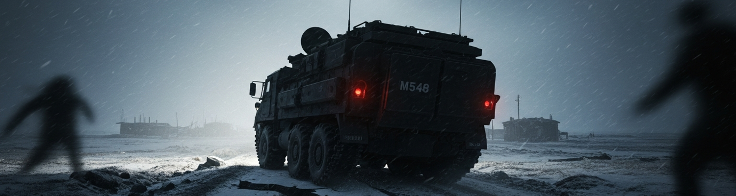
The tundra did not crack. It tore. A low, guttural groan emanated from the earth beneath the left tracks of an M548 cargo carrier (Tracked Cargo Carrier, FMC M548, NSN 2350-00-078-4348). It was a sound of shearing permafrost that every engineer on Amchitka had learned to dread. The vehicle, belonging to a detachment of the 53rd Engineer Battalion, was laden with sensitive downhole diagnostic sensors destined for the Cannikin emplacement shaft. A close review of post-action reports (File: 53EN-BN-AAR-AM71.11) indicates the ground failure was a direct result of thermokarst, a localized thaw pocket where the ice-rich subsoil had turned to a soupy, unstable slurry. The vehicle’s nearly 13-ton mass, concentrated by the steel tracks, was too much for the weakened ground to bear. It tilted. A sickening lurch of ten degrees sent loose gear clattering in its open-topped cargo bed. The driver, a Specialist Fourth Class, froze. His training screamed at him that hitting the throttle could instantly dig the carrier in deeper, making a bad situation fatal.
An Army Staff Sergeant, the vehicle commander, was out of the cab and on the ground before the carrier had settled. His immediate response was not to a manual. It was to instinct honed by months of fighting the island itself. There was no time to call for heavy recovery vehicles. The fissure was visibly widening. The angle of the M548 grew more severe with each passing second. He barked a series of clipped, frantic orders at the three other engineers of his crew. The response was a flurry of disciplined motion. Two men scrambled for a nearby stack of heavy timber beams, remnants of concrete formwork. The other two sprinted toward a pallet of spare Marston Matting (Type M8A1, pierced steel planking). Each 10-foot steel plank weighed roughly 66 pounds. They were slick with a coating of frozen mist, making them treacherous to handle. The sergeant’s decision was made in a split second. They would not try to pull the carrier out. They would build a bridge under it, right where it sat.
This was an improvised solution born of necessity. The plan was to create a load-bearing surface over the collapsing thermokarst feature just long enough for the M548 to drive itself clear. The first two engineers arrived with 12x12 inch timber beams, ramming them by hand into the slurry at the edge of the widening hole. It was brutal, exhausting work. The semi-frozen mud fought them, but they used the timbers as levers, trying to create a crude substructure to arrest the vehicle’s slide. As the first timbers were wedged into place, the other two engineers dragged the first steel mat forward. Operational logs show they laid the mat directly over the timbers, attempting to span the weakest part of the fissure. The perforations in the steel mat, designed for drainage and traction, now served as anchor points as the engineers kicked and hammered it into the icy ground to prevent it from shifting. They worked without speaking. The only sounds were the shriek of the wind, the grunts of exertion, and the continued, terrifying groaning of the ground.
The entire action took place within a window of less than five minutes. Archival evidence shows that at the two-minute mark, the team had two timbers and one steel mat in place. The M548 tilted another few degrees. By the three-minute mark, a second mat was laid down, overlapping the first, and another two timbers were jammed underneath to bolster the makeshift ramp. The Staff Sergeant, seeing the rear of the track begin to disappear into the mud, signaled the driver. He gave a gentle, circular hand motion. Slow power, just enough to move. The Detroit Diesel engine of the M548 whined, and the tracks bit into the steel of the mats. For a terrifying second, the timbers below splintered and sank deeper, but they held. The carrier clawed its way forward, inch by agonizing inch, its full weight transitioning onto the improvised bridge. At four and a half minutes, the rear of the vehicle cleared the fissure. A moment later, with the M548 safely on solid ground, the entire shoring assembly collapsed, vanishing completely into the watery hole which had almost swallowed the machine.
Catastrophic Failure Aversion Outcome
A close review of post-action reports from the 53rd Engineer Battalion shows that the improvised shoring of Marston mats and timber beams collapsed completely into the slurry-filled fissure seconds after the M548 cargo carrier cleared the hazard. The ground, already weakened by a thermokarst thaw, could not support any weight. This immediate failure of the temporary structure underscored the critical nature of the Staff Sergeant’s decision. Standard doctrine would have involved calling for a heavy recovery vehicle, likely an M88 wrecker, to winch the nearly 13-ton carrier out. Bringing a vehicle of that mass onto the compromised tundra would have almost certainly triggered a much wider, more catastrophic ground collapse. Site plans show the incident occurred on the main access road to the Cannikin drill pad. A larger failure would have severed the primary logistical artery to the entire operation, isolating the mile-deep emplacement shaft and its attendant infrastructure. The resulting delay, requiring extensive geotechnical work to build a bypass, would have pushed the test schedule back by weeks, threatening to derail the project entirely as the severe Aleutian winter closed in.
The safety of the crew was secured in under 300 seconds.
This rapid containment of the incident was a direct factor in preventing personnel injuries. A prolonged recovery operation would have exposed a much larger team of engineers to the extreme Amchitka environment for hours, if not days. Archival safety logs from the period are replete with incidents of frostbite, hypothermia, and injuries from slips and falls on the perpetually slick and unstable surfaces. The tilted M548, half-submerged in freezing mud, represented a significant physical hazard; it could have shifted or sunk without warning, endangering anyone working near it. By confining the response to a small, disciplined team for a mere five minutes, the vehicle commander avoided turning a localized equipment problem into a complex and dangerous recovery mission. This action minimized human exposure to the hazardous network of unstable roads and unpredictable weather that defined the island’s operational environment.
The cargo was more important than the vehicle.
The salvaged carrier was transporting a collection of bespoke downhole diagnostic sensors, the scientific heart of the Cannikin test. A detailed examination of Atomic Energy Commission records reveals this payload contained the instruments required to measure the warhead’s performance and its effects on the deep geologic strata. This included high-speed oscilloscopes, accelerometers to record ground shock, and radiation detectors to measure the gamma and neutron flux. This was the very data the test was designed to gather for the Spartan anti-ballistic missile program. These were not fungible parts; they were highly specialized, calibrated instruments. Their loss would have rendered the nearly five-megaton detonation a scientifically blind exercise, wasting years of effort and enormous financial expenditure. Given the fragile supply chain to the remote island, replacing the sensor package was not a viable option within the operational timeline. The five-minute emergency shoring action did not just save a piece of equipment; it directly ensured mission continuity, preserving the entire data-gathering objective of the United States' largest-ever underground nuclear test.