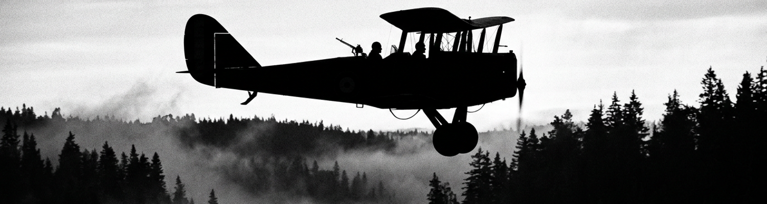

Encirclement in the Charlevaux Ravine
Field transmission logged at 0830 hours on October 3 reported American forces dug in along the northern slope of the Charlevaux Ravine. Grid coordinates read 294.2-276.4. The unit was under multi-directional machine gun fire. All rear communications were severed.
Archival evidence shows the tactical crisis began late in the afternoon on October 2, 1918. Major Charles Whittlesey commanded a composite assault force. This force centered on the 1st Battalion of the 308th Infantry Regiment, 77th Division. Elements of the 2nd Battalion and Company K of the 307th Infantry Regiment reinforced the line. Gun crews from Companies C and D of the 306th Machine Gun Battalion provided heavy weapons support. Whittlesey pressed through dense brush toward the Binarville-La Viergette road near Charlevaux Mill. His infantry captured Hill 198. They obeyed strict standing orders to advance regardless of adjacent unit progress.
French forces on the left flank stalled in front of heavily fortified German positions near Challerange.
The American 28th Division on the right flank suffered heavy casualties and halted. The German 76th Reserve Division and 252nd Landwehr Regiment exploited the widening gap. German troops reoccupied the high ground to the south. They emplaced Maxim MG 08 machine gun nests along the cliffs. Whittlesey's command was trapped inside a steep depression.
Over five hundred and fifty men were completely encircled within a perimeter measuring less than three hundred yards wide by one hundred yards deep.
Starvation struck the pocket within hours of encirclement on October 3. Soldiers entered the ravine carrying only individual iron rations. These consisted of two tins of hard bread, bacon, and coffee. Most men had consumed these rations during the preceding twenty-four hours of combat. Water access required men to crawl down the exposed southern slope to the Charlevaux Creek. This muddy stream was swept by continuous German sniper fire and fixed-line machine guns. Dozens died attempting to fill canteens.
Medical supplies evaporated almost instantly.
Bandages in standard first-aid pouches were depleted after treating the initial seventy casualties. Battalion surgeons used soiled rags and strips torn from cotton undershirts on open abdominal wounds. Small arms ammunition reserves reached dangerous thresholds before noon. Riflemen armed with M1903 Springfield and M1917 Enfield rifles were down to their last cloth bandoliers. Hotchkiss M1914 and Chauchat automatic rifle crews exhausted their loaded magazine pans during early morning defensive skirmishes.
Every runner dispatched south across the slope was shot by German snipers concealed along the ridge lines.
A close review of operational logs indicates the physical breakdown of communication infrastructure accelerated the collapse. Signal Corps personnel unspooling field telephone wire through the swampy creek bed were killed. This severed the physical telegraphic link to 77th Division headquarters at Binarville. Major Whittlesey relied entirely on homing pigeons from Mobile Loft 9 to transmit grid coordinates and casualty tallies. French-made 37mm infantry cannon ammunition ran out. Gun crews removed and buried the breech blocks to render the weapons useless to enemy raid parties. Without iodine or basic antiseptics, infection set into compound fractures within forty-eight hours.
By October 4, battalion orders prohibited un-aimed defensive fire.
Soldiers were restricted to single-shot responses against confirmed enemy targets to preserve their remaining clips of five rounds.
Severed Ground Corridors and Machine Gun Nets
The physical layout of the German blockade rested on the precise positioning of Maxim MG 08 water-cooled machine guns. Elements of the German 76th Reserve Division and the 252nd Landwehr Regiment constructed defensive emplacements along the high crests of the southern ridge. These positions directly overlooked the Binarville-La Viergette road. Engineers bolted heavy Schlitten 08 sled mounts onto log-reinforced parapets. They locked down the elevation screws to fix exact fields of fire across the slope.
Ammunition crews stacked wooden crates containing 250-round fabric belts of 7.92x57mm Mauser cartridges inside concealed dugouts.
Gunners positioned two to three weapons at strategic apexes along the rim. This created overlapping fire cones. Every square yard of the open slope falling away from the ridge down to the Charlevaux stream bed became a pre-calibrated kill zone. Gunners locked the traversing gear on their mounts. They maintained continuous low-trajectory fire across the glades even during periods of zero visibility or heavy smoke.
Thick forest cover offered no protection against fixed-line fire.
Archival evidence shows supply parties attempting to carry ammunition crates and rations north from 154th Infantry Brigade headquarters ran straight into this interlocking network. German gun crews operated on strict conservation cycles. They rotated fire between paired weapon positions to prevent barrel overheating and steam emission from the condenser jackets. American support elements tried to force ground supply trains up the ravine approaches. Spotters from the 76th Reserve Division signaled battery targets back to artillery units holding Hill 198.
German 7.7 cm FK 96 n.A. field guns fired air-burst shrapnel shells directly into the tree lines.
These shells shredded wooden supply packs and pack mules. Ground resupply columns from the 307th and 308th Infantry Regiments were pinned down before reaching within four hundred yards of Major Whittlesey's perimeter. Left exposed on open inclines, wooden supply crates containing M1906 .30-06 ammunition bandoliers were abandoned along the trail.
Overland resupply ceased completely by late afternoon on October 3.
A close review of operational logs indicates the human cost of maintaining tactical contact fell entirely upon battalion runners. Field telephone wires were cut by shell splinters. Wireless equipment was unavailable. Major Whittlesey dispatched pairs of infantry couriers from Companies A, B, and C of the 308th Infantry Regiment. Their task required climbing the steep 50-degree southern slope of the ravine. They had to cross the exposed clearing along the Binarville road and penetrate back to 154th Brigade command posts.
Couriers carried handwritten dispatches wrapped in oilcloth pouches.
These pouches contained grid references and urgent supply requisitions. German marksmen equipped with telescopic-sighted Gewehr 98 rifles held daylight surveillance over every clearing. As runners emerged from the brush into open ground, snipers hit them immediately. Multiple couriers died within thirty yards of Whittlesey's command post. They were struck by high-velocity Mauser rounds before reaching the upper ridge line.
Not a single courier dispatched south on October 4 reached American lines.
Logistics reports from the 77th Division reveal commanders sent over thirty runners into the gap between October 3 and October 5. Only one runner successfully slipped through the German lines. Private Abraham Krotoshinsky of Company K crawled through brush for hours on October 8. The immediate result of courier attrition was a complete lack of information at higher headquarters. Division officers possessed no reliable map locations for the pocket. They assumed Whittlesey had fallen back or been wiped out.
Ground couriers carrying mapping overlays lay dead across the ravine floor.
Their leather dispatch cases rusted in the mud. Without human link-ups to direct relief columns, infantry support regiments remained paralyzed behind the German machine gun positions along the high ridges.
Aerial Reconnaissance Failures of the 50th Aero Squadron
Responsibility for aerial contact fell upon the 50th Aero Squadron of the American Expeditionary Forces Air Service. This unit operated out of Remicourt Aerodrome. Aircrews flew American-built De Havilland DH-4 biplanes powered by 400-horsepower Liberty L-12 engines. They received urgent orders on October 5 to locate Major Charles Whittlesey's isolated command inside the Charlevaux Ravine.
Pilots flew dangerous low-altitude sorties.
They descended below three hundred feet to trace the contours of the Aire River valley and the steep forested slopes around Binarville. At treetop level, these bulky two-seater aircraft became easy targets for German infantry holding the surrounding high ground. Gunners from the 76th Reserve Division directed heavy streams of 7.92mm armor-piercing fire upward from concealed trench lines. Maxim MG 08 positions along the upper cliffs fired down directly onto the exposed upper wings and open cockpits.
Multiple aircraft returned to base with severed control cables, punctured fuel tanks, and shredded fabric fuselages.
Ground contact proved nearly impossible from the air.
Archival evidence shows environmental obstacles completely blocked visual observation throughout the early morning hours. Dense morning river fog pooled in the narrow Charlevaux creek bed. This masked the bottom of the ravine under heavy water vapor. Persistent autumn winds failed to disperse this fog before noon. Below the fog line, an oak forest and pine canopy formed a thick layer of overlapping branches over the American perimeter.
Air Service doctrine required trapped infantry to lay out white cloth signal panels.
These panels had to be placed on open ground in specific geometric shapes to mark exact grid coordinates. Major Whittlesey's men possessed these white bedsheet strips. Displaying them in the sparse clearings invited immediate mortar barrages and sniper fire from German spotters on Hill 198. Fearing annihilation from enemy artillery, American infantry kept their signal sheets hidden beneath heavy hemlock boughs. This rendered the battalion invisible to friendly observers flying overhead.
Thick foliage absorbed all visual markers.
A close review of operational logs indicates pilots attempted to deduce the perimeter by deliberately drawing enemy ground fire. On October 6, First Lieutenant Harold E. Goettler and Second Lieutenant Erwin R. Bleckley volunteered for a second low-level reconnaissance run in DH-4 Number 2. Their initial morning flight yielded no confirmed coordinates. Flying barely fifty feet above the timberline, Goettler maneuvered the biplane across the ravine. Bleckley leaned over the cockpit rim with map sheets to plot the origin of German muzzle flashes.
Intense machine gun crossfire riddled the airframe with over forty bullet holes.
Both aviators were mortally wounded before their plane force-landed near a French outpost north of Binarville. Notes recovered from Bleckley's map case provided updated sector boundaries. Aerial resupply efforts remained highly inaccurate.
Drop bundles plummeted straight into enemy trenches.
Without precise visual verification from the ground, the 50th Aero Squadron dropped more than twelve hundred pounds of emergency supplies between October 5 and October 7. Flying crews kicked wooden crates containing hardtack, canned corned beef, medical gauze, and bandoliers of .30-06 ammunition over the sides of their cockpits into the mist. The vast majority of these improvised wicker supply baskets drifted off target. They landed on the northern slope of the ravine or directly inside the perimeter held by the German 252nd Landwehr Regiment.
Trapped American soldiers watched starved German garrisons retrieve full resupply bundles less than fifty yards from their foxholes.
On October 7, aircrews mistakenly dropped mapping overlays and radio codes onto German positions. This supplied enemy intelligence officers with complete American operational plans.
Inaccurate Topographical Maps and Coordinate Errors
The foundational structural cause of the tactical disaster lay in the outdated mapping assets issued to American Expeditionary Forces officers. Division and brigade command posts operated from French 1:20,000 scale topographical maps created years before the war. These were supplemented by hasty military overlays containing severe grid registration errors. Tactical planners at 77th Division headquarters plotted troop movements using French Lambert grid references. These references failed to accurately represent the steep, narrow topography of the Charlevaux Ravine.
The physical contours of Hill 198 and the northern slope had been drawn with incorrect elevation lines.
This distorted real-world distances between the Binarville-La Viergette road and adjacent ridges by several hundred meters. Major Charles Whittlesey's actual position along the northern slope fell into a geographic offset on command post plotting boards. Operational maps placed the 1st Battalion of the 308th Infantry Regiment along the southern slope. The maps claimed the northern incline remained entirely in German hands.
Outdated cartographic grids miscalculated the physical location of the ravine by hundreds of meters.
Archival evidence shows this mapping discrepancy proved catastrophic when the 152nd Field Artillery Brigade attempted to establish a protective artillery screen around the pocket on October 4, 1918. Batteries from the 304th and 305th Field Artillery Regiments unlimbered French 75mm Model 1897 light field guns and 155mm Schneider howitzers along the ridge line to the south. Battery commanders calculated elevation settings, drift corrections, and deflection angles using the flawed grid coordinates supplied by division intelligence officers.
Target orders aimed to drop a dense shell wall along grid line 276.4.
This was intended to suppress German machine gun emplacements on the upper rim. Because operational maps shifted the American perimeter nearly five hundred meters south of its physical location, the target grid fell directly onto Major Whittlesey's foxholes. Gun crews loaded high-explosive instant-detonation fuse shells. They set elevation screws for a protective barrage intended to clear enemy ground.
At 1430 hours on October 4, friendly artillery batteries opened fire directly into the trapped American lines.
A close review of operational logs indicates the barrage struck with exact precision along the northern slope of the ravine. Shells ripped through the pine canopy. They detonated among tree trunks, showering shrapnel and wooden splinters into the exposed foxholes of the 308th Infantry Regiment. Trapped soldiers dug deeper into the clay using bayonets and mess kits. 75mm high-explosive shells exploded at a rate of fifty rounds per minute.
Friendly fire collapsed dirt dugouts.
It crushed makeshift aid stations and severed what little cover the terrain provided. Officers attempted to signal back to division headquarters using smoke candles and flare pistols. Thick canopy foliage and lingering cordite smoke obscured all ground visual signals. The barrage continued unabated for nearly eighty minutes. It inflicted over thirty fatalities and wounded eighty men within the small perimeter.
Friendly shrapnel inflicted more rapid casualties than three days of enemy small-arms fire.
Desperate to halt the shelling, Major Whittlesey dispatched his final homing pigeon, Cher Ami, from Mobile Loft 9 at 1500 hours. The bird carried a frantic handwritten dispatch detailing exact coordinates along the road running alongside line 276.4. The message confirmed American shells were exploding directly on friendly troops. The pigeon flew through dense rifle and machine gun crossfire. The bird sustained severe wounds before reaching division lofts twenty-five miles to the rear at Rampont.
Staff officers at 77th Division headquarters processed the dispatch at 1600 hours.
They matched the corrected coordinates against their battery plotting boards. Command officers radioed firing holds to the 152nd Field Artillery Brigade. They halted the barrage at 1620 hours. Cartographic miscalculations had turned friendly artillery into the main cause of American casualties.
Misdirected Quartermaster Air Drops and Enemy Interception
The supply crisis deepened on October 5, 1918. The American Expeditionary Forces Air Service launched the military's first combat airlift operations to sustain Major Charles Whittlesey's isolated pocket. Quartermaster Corps personnel at supply depots behind the lines worked in hasty coordination with 77th Division headquarters. They packed improvised resupply containers. They did this without specialized parachutes or delayed-drop rigging. Crews stuffed wicker laundry baskets and wooden crates with hardtack tins, canned corned beef, roll bandages, vials of iodine, and cloth bandoliers containing .30-06 Springfield rifle cartridges.
Pilots from the 50th Aero Squadron took off under strict orders.
Flying American-assembled De Havilland DH-4 biplanes powered by Liberty L-12 engines out of Remicourt Aerodrome, they were instructed to kick these heavy bundles over the cockpit rims while flying over the Charlevaux Ravine. Flying through thick fog and heavy low-altitude anti-aircraft fire from the surrounding slopes required aviators to release their loads from elevated altitudes. Sometimes they dropped them during high-speed banking maneuvers.
High-altitude drops plummeted past the perimeter and shattered across German-controlled ridges.
Archival evidence shows the American perimeter inside the ravine measured less than three hundred yards long by one hundred yards wide. Nearly all of the improvised Quartermaster supply bundles missed their targets completely. Strong autumn wind currents funneling through the narrow valley pushed the unguided wooden crates past American lines. The crates tumbled directly into trenches held by the German 252nd Landwehr Regiment and the 76th Reserve Division.
German infantrymen had been enduring severe supply shortages due to the broader Allied naval blockade.
They routinely captured intact crates containing hundreds of pounds of high-calorie rations, clean medical dressings, and fresh small-arms ammunition. Enemy machine gun crews guarding the upper cliffs retrieved unopened boxes of American .30-06 cartridges alongside tins of corned beef and packages of tobacco. Trapped doughboys from the 308th Infantry Regiment were immobilized by starvation and infection inside their shallow foxholes. They were forced to watch enemy soldiers unwrap fresh American rations less than fifty yards beyond their northern defensive line.
Surrounding German garrisons used the captured medical gauze and antiseptics to treat their own casualties inside fortified dugouts along Hill 198.
A close review of operational logs indicates German officers quickly exploited the failure of the aerial resupply effort through tactical deception. German frontline troops laid out white cloth signal panels across their own trench parapets. They used identical geometric configurations to those specified in American signal doctrine. This intentionally tricked 50th Aero Squadron pilots into dropping supply loads directly over German positions.
Major Whittlesey ordered his men to fold up and hide their official white bedsheet markers under dense hemlock branches.
Displaying the cloth strips immediately drew concentrated mortar shells and heavy Maxim MG 08 machine gun fire from enemy observers overlooking the ravine floor. Between October 5 and October 7, aircrews pushed over twelve hundred pounds of freight out of DH-4 cockpits. Less than five percent of the material landed within reach of Whittlesey's command. On October 7, a misdirected drop delivered sensitive military overlays and radio call-sign sheets directly into the hands of intelligence officers from the German 76th Reserve Division at Binarville.
Post-War Autopsy of Army Air Resupply Operations
Post-war military inquiries conducted by the American Expeditionary Forces Superior Board exposed severe structural deficiencies in the aerial resupply missions carried out over the Charlevaux Ravine. Between October 5 and October 7, 1918, pilots of the 50th Aero Squadron operating De Havilland DH-4 biplanes from Remicourt Aerodrome dropped more than twelve hundred pounds of rations, medical gauze, and .30-06 ammunition bandoliers into the fog-choked valley.
Archival evidence shows ninety-five percent of these drop containers missed the target area around grid coordinates 294.2-276.4.
They plummeted directly into German positions held by the 252nd Landwehr Regiment. The fundamental flaw identified by tactical evaluators rested on the complete absence of two-way radio communication between ground forces and airborne crews. American biplanes lacked airborne wireless transmitters capable of receiving real-time signal updates from the infantry perimeter below. Pilots relied entirely on unguided manual releases out of open cockpits. They navigated at altitudes exceeding three hundred feet under continuous ground fire from Maxim MG 08 machine gun positions.
Without direct radio feedback, aircrews could not verify ground coordinates.
Emergency supplies fed enemy garrisons while American soldiers inside the pocket starved. Manual air drops out of unequipped biplanes turned basic resupply into an indirect donation to enemy lines.
A close review of operational logs indicates post-war technical boards focused heavily on the physical mechanics of the drop containers themselves. Quartermaster personnel at rear depots had packed standard wicker laundry hampers and heavy wooden ammunition crates without parachutes or aerodynamic stabilization devices. Dropped from high-speed DH-4 biplanes powered by 400-horsepower Liberty L-12 engines, these unguided loads tumbled erratically through variable atmospheric crosswinds funneling through the narrow ravine.
Inaccurate 1:20,000 scale French topographical maps compounded the technical breakdown.
These maps placed Major Charles Whittlesey's 1st Battalion of the 308th Infantry Regiment hundreds of meters south of its actual position along the northern incline. Command officers at 77th Division headquarters issued flight path vectors based on these flawed Lambert grid overlays. This ensured even perfectly executed drops released over assigned sectors fell outside the perimeter. German intelligence officers recovered intact American mapping overlays and secret code sheets from misdirected supply bundles on October 7. This confirmed the location and vulnerability of the isolated troops.
Inaccurate topographic grids combined with unguided airborne drops to strip the encircled battalion of both supplies and operational secrecy.
The operational breakdown in the Argonne directly reshaped how the United States Army conceptualized aerial logistics during the interwar era. Formal post-war autopsies compiled by the Air Service Tactical School at Langley Field cited the Charlevaux Ravine failure as the primary impetus for developing specialized air supply doctrine. Tactical planners systematically eliminated unguided free-fall drops. They mandated the engineering of dedicated cargo parachutes, shock-absorbing supply canisters, and standardized release mechanisms for transport aircraft.
Army signal corps doctrine underwent a parallel overhaul.
It established mandatory protocols for continuous two-way radio integration between ground infantry commanders and observation aircraft. Military mapping divisions replaced outdated allied cartography with standardized high-precision grid projection systems linked to aerial photographic survey units. By 1926, the newly designated United States Army Air Corps integrated dedicated air resupply exercises into its core field service regulations. This codified the lessons of the 50th Aero Squadron into a standardized operational manual for enclosed theater logistics. Air Service quartermaster units established specialized air-drop packing manuals based explicitly on the cargo losses logged between October 3 and October 8, 1918.