
Formation and Early Doctrine of Amphibious Scouts
A grease-stained machinist mate knelt over the exposed Gray Marine 6-71 diesel inside a wooden scout boat. He tightened the brass fuel line coupling with a six-inch open-ended wrench. Sea spray coated the cold exhaust manifold. He adjusted the idle screw down to six hundred revolutions per minute. This mechanical adjustment muffled the engine to prevent acoustic detection from the dark shoreline three miles off Fedala. He secured the copper wire through the retaining bolt. Vibration would not back the fastener out mid-run. Two hours later, an eight-foot Atlantic roller picked up the hull. The wave rolled the craft forty-five degrees. Three tons of salt water submerged that dry fuel pump.
The planning manuals failed on contact with the ocean.
Archival evidence shows this mechanical vulnerability originated directly from the rushed creation of the joint Army and Navy Scout and Raider training facility at Amphibious Training Base Little Creek in August 1942. Confronted with the immediate timetable of Operation Torch, the Navy Department paired naval officers like Lieutenant Phil H. Bucklew with volunteers drawn from the Army 9th Infantry Division and Navy demolition units. Recruits arrived at the southern shore of the Chesapeake Bay with less than ten weeks to master an unproven trade. Instructors at Little Creek divided the daily schedule between physical conditioning and small-craft maintenance. They drilled soldiers and sailors together in coastal scouting techniques. Operational records reveal command staff had to invent an organizational chart on the fly. They mixed naval ratings with infantry lieutenants in four-man scout teams. Little Creek lacked standardized vessels. Early classes trained aboard modified civilian Chris-Craft cruisers and thirty-six-foot Eureka hulls. Quartermasters scrambled to procure blackout paint and compasses.
Speed replaced depth.
When examining the historical record, planners anchored every tactical assumption to the rigid frameworks of Fleet Training Publication 167. This manual viewed an amphibious assault primarily as an orderly clockwork exercise conducted across glassy water. FTP 167 dictated scout elements would lead assault waves across predictable offshore lines of departure. They would utilize shielded red or blue running lights to mark landing lanes. Planners believed total darkness coupled with precise magnetic compass bearings would insulate the assault force from detection. Tactical diagrams inside FTP 167 depicted troop-laden landing craft moving abreast toward gentle sandy gradients. These diagrams assumed water untouched by disruptive oceanic currents. The manual provided precise formulas for boat spacing and wave intervals down to the thirty-second mark. It omitted procedures for operations in heavy nearshore breaks or blinding coastal mist.
The sea did not obey the handbook.
A close review of operational logs indicates the Little Creek curriculum heavily stressed stealthy boat handling at the expense of open-ocean surf navigation. Trainees logged hundreds of night hours inside the calm shallows of Lynnhaven Inlet. They learned to paddle rubber rafts without splashing. They synchronized boat throttles to reduce acoustic signatures. Instructors evaluated crews on their ability to creep past anchored patrol craft without being spotted by searchlight crews. Oceanic wave dynamics received no formal instructional time. The trainees never experienced Atlantic swells above five feet during their Virginia training sequence. This left them unprepared for the ten to fifteen foot groundswells waiting off the Moroccan coastline. Standard Higgins Eureka boats possessed flat aft sections and low freeboards. These hulls operated well in quiet estuaries. They swamped rapidly when breaker waves struck their stern quarters. On November 8, 1942, Atlantic breakers over fifteen feet high tore those flat-bottomed craft apart along the rocky reefs of Fedala.
Transatlantic Logistics and Fleet Replenishment Bottlenecks
When examining the historical record, the mechanical strain of the transatlantic crossing exposed severe flaws in prewar fleet support. Task Group 34.8 relied on oilers like the fleet tanker USS Kennebec (AO-36) to sustain screening destroyers during the 4,000-mile passage from Virginia to French Morocco. Heavy Atlantic swells running twelve to eighteen feet repeatedly disrupted underway replenishment runs between October 28 and November 4. Six-inch rubber fueling hoses snapped under erratic surge tension. Escort destroyers like USS Eberle rolled forty degrees while attempting to maintain station eighty feet abeam of the tankers. Bronze line couplings sheared off at the receiving manifolds. Thousands of gallons of heavy fuel oil spilled across flooded decks.
Each breakaway forced oiler crews to haul wet lines back aboard by hand.
They replaced stripped winch cables and repaired split canvas gaskets in pitch darkness. Pumping operations that prewar doctrine estimated at three hours stretched past eight hours in open water. Tankers were forced to slow the entire formation to eight knots in submarine waters. This exposed ship hulls to German torpedoes while deck hands worked to secure damaged fueling booms.
Rough water repeatedly broke the refueling gear.
A close review of operational logs indicates these replenishment failures produced an acute fuel crisis across the Western Naval Task Force. Combat-loaded transports spent two weeks zigzagging at twelve knots to evade German U-boat patrols. These included USS Leonard Wood, USS Thomas Stone, and USS Joseph Hewes. Constant rudder shifts and boiler adjustments burned bunker C fuel oil at rates twenty percent above peacetime consumption tables. Transports lacked the specialized fueling rigs needed to take oil from tankers in heavy Atlantic swells. They burned through their onboard bunkers without mid-ocean replenishment. By November 7, the ships reached positions fifteen miles off the Moroccan coastline near 33 degrees 43 minutes north latitude. Fuel gauges on multiple transports registered below fifteen percent capacity. Several escorting destroyers retained barely twenty-four hours of operational endurance in their service tanks. Assault commanders possessed no margin to maintain steam offshore in circular holding patterns. Transport divisions could not retreat west into the open Atlantic if French shore batteries repelled the landings.
The fleet possessed only one chance to put troops ashore.
Archival evidence shows this fuel deficit dictated extreme operational constraints for the amphibious scout units. Rear Admiral H. Kent Hewitt and transport division leaders eliminated preliminary daylight reconnaissance runs. This prevented transport engines from burning fuel while idling against strong coastal currents. Transport captains demanded scout crews hit the water under complete darkness at 2300 on November 7. This established an inflexible launch schedule with zero margin for error. Four-man Scout and Raider teams dropped from transport davits into thirty-six-foot wooden scout boats eight miles out to sea. They faced an absolute ninety-minute deadline to locate the shoreline of Fedala. The scout crews had to identify the rocky headlands of Cape Fedala and the Pont Blondin promontory without radar. They needed to ignite shielded red and green marker lanterns to define landing beaches Red, Blue, and Yellow. They had to guide the primary assault waves forward before 0400. Any mechanical delay in boat engines or drift off course would strand landing craft in heavy ocean surf. The transports lacked the bunker reserves needed to hold position until morning.
At 2315, the first wooden scout craft dropped into sixty-degree ocean water under strict radio silence.
Intelligence Failures in the Casablanca Preliminary Study
Archival evidence shows Task Group 34.8 based its operational landing plan on the Office of Naval Intelligence Preliminary Study of Casa Blanca. This was a speculative intelligence folio assembled in Washington without empirical field verification. Staff planners working under strict wartime secrecy compiled the text using outdated French civilian charts from the 1920s. They also used merchant marine logs and prewar tourist maps of the Moroccan coast. These paper folios provided sounding depths for commercial shipping berths inside the Casablanca harbor breakwater. They contained no systematic soundings for the nearshore surf zones along Beaches Red, Blue, and Yellow near 33 degrees 43 minutes north latitude. Rear Admiral H. Kent Hewitt and his navigation staff plotted assault waves toward Cape Fedala using hydrographic profiles drawn at scales far too broad to isolate shallow hazards. Naval intelligence officers never dispatched reconnaissance submarines to take manual lead-line soundings. They feared alerting Vichy French coastal batteries. Lacking empirical soundings, assault planners assumed the Moroccan shoreline mirrored the predictable bathymetry of the American mid-Atlantic coast.
Outdated merchant soundings substituted for verified military hydrography.
When examining the historical record, the intelligence staff omitted critical local gradient charts. These missing charts documented the steep bathymetric shelf fronting the Moroccan littoral. Deep underwater trenches channeling straight toward Fedala Bay allowed long-period wave trains to roll toward shore without losing kinetic energy across a wide continental shelf. These wave trains were generated by violent low-pressure storms four thousand miles away in the North Atlantic. Local French port authorities at Casablanca kept detailed daily tide and surf registers. These registers recorded autumn ground swells that routinely surpassed fifteen to twenty feet. American analysts failed to acquire or translate these records during planning. Planners instead promised landing boat skippers manageable three to five foot breaking seas based on peacetime fleet manuals. Unwarned by the intelligence brief, coxswains had no mechanical defense when these underwater energy waves struck the sudden coastal shelf. Eighteen-foot Atlantic ground swells reared vertically out of the darkness at eighteen-second intervals. They capsized thirty-six-foot wooden hulls with tons of falling water.
Eighteen-foot rollers broke directly across the landing lanes.
A close review of operational logs indicates inaccurate coastal depth profiles inside the preliminary study thoroughly disguised a system of submerged sandbars and steep drop-offs flanking the Fedala beaches. Intelligence blueprints depicted a gentle continuous shoreward incline. Planners believed landing craft could drive their bows firmly onto dry sand. The actual nearshore bottom featured a treacherous double-bar formation separated by six to eight foot troughs of scouring backwash. When Higgins Eureka boats struck the hidden outer bar two hundred yards offshore, coxswains dropped ramps in pitch darkness. They held the mistaken belief they had reached dry land. Soldiers carrying sixty-pound field packs stepped into water eight feet deep. They sank under their equipment. Ocean surges threw trailing assault craft directly over the sandbars. This ripped rudders from their pintles and sheared bronze propeller shafts against submerged granite outcrops.
At 0420, twenty-one landing boats lay wrecked in the Fedala surf line.
Experimental Night Guidance Systems and Mechanical Failures
Salt brine destroyed the secret electronics within forty minutes of deployment.
Archival evidence shows Task Group 34.8 equipped Scout and Raider teams with experimental infrared signaling transmitters. The Naval Research Laboratory designed these devices to guide incoming landing waves invisibly. Technicians encased the tungsten filament lamps inside sealed brass housings topped with dark optical filters. These filters blocked visible red rays while permitting near-infrared wavelengths to pass toward handheld phosphor viewing receivers aboard lead Higgins boats. Naval planners assumed these unproven devices would broadcast clear infrared tracks from boat decks anchored two miles off Beach Red at 33 degrees 43 minutes north latitude. The Atlantic surge shattered that theoretical assumption. Heavy ocean spray carrying thirty-five grams of dissolved salt per liter hammered the unsealed battery contacts. It flooded vulcanized rubber wire grommets on the scout craft gunwales. Corrosive brine seeped through poorly vulcanized cable joints. This caused instantaneous galvanic reactions between exposed copper leads and zinc mounting plates. Dead short circuits drained the delicate six-volt lead-acid storage cells completely by 0115. Receiver operators staring through the specialized optical viewing scopes aboard USS Leonard Wood found only total blackness across the water.
Exhaust modifications designed for acoustic concealment crippled the boat engines next.
A close review of operational logs indicates the Scout and Raider craft carried custom underwater exhaust bypass systems fabricated at Norfolk. These systems were designed to baffle the acoustic signature of their 225-horsepower Gray Marine diesels. Bureau of Ships engineers installed bronze flapper valves and water-jacketed mixing chambers. These directed hot diesel exhaust gases directly into the prop wash beneath the waterline. Scout boat coxswains throttled down to three knots to hold station off Cape Fedala against a two-knot north-setting rip current. The cooling water volume delivered by the engine-driven bronze sea pumps collapsed by seventy percent. Low propeller shaft revolutions generated insufficient water flow through the auxiliary cooling jackets. Uncooled exhaust backpressure spiked to fifteen pounds per square inch inside the cast-iron manifolds. This blew copper-asbestos head gaskets and cracked cylinder head jackets. Boiling engine coolant geysered across the engine compartments as internal temperatures climbed past two hundred and forty degrees Fahrenheit. Two scout crews drifted helplessly toward the rocky shoals of Pont Blondin. Blown exhaust valves caused catastrophic compression loss on their primary propulsion blocks.
Physical optics failed along the breaking coastline.
When examining the historical record, scout teams falling back on standard secondary optical systems found their shielded directional lamps entirely neutralized by nearshore weather. Tactical orders instructed scouts to position themselves eight hundred yards off Beaches Blue and Yellow. They were to aim hooded electric signal lanterns equipped with narrow ten-degree sheet-metal louvers seaward to establish alignment lanes for approaching assault waves. A localized temperature inversion had drawn a dense layer of cold coastal sea haze over the Fedala littoral between midnight and 0300. This haze hung directly above crashing surf lines that generated an airborne mist wall twenty feet high. The tiny ten-watt focused beams possessed insufficient luminous flux to cut through the airborne suspension of moisture particles and pulverizing sea foam. Salt crust rapidly frosted the glass lenses of the signal lamps. This scattered the directed light into an imperceptible dim glow that failed to travel more than seventy yards seaward. Coxswains in the trailing assault waves of the 3rd Infantry Division never identified the designated light markers. They drifted three miles off course onto the jagged granite reefs fronting Cape Fedala.
Navigation Hazards Along the Cape Fedala Reefs
Archival evidence shows deep-ocean swells rolling unchecked across the Atlantic Shelf slammed into the promontory of Cape Fedala near 33 degrees 43 minutes north latitude by 0215 on November 8. Wave periods reached eighteen seconds. These massive wave formations contacted the sudden thirty-foot shoals flanking the cape. Wave heights doubled from eight feet to sixteen feet in less than forty yards. Scout and Raider detachments operating thirty-six-foot wooden reconnaissance craft found their sterns lifted vertically without warning. Transom rudders lost all water bite. Coxswains spun bronze steering wheels against dead linkages as following seas drove the blunt bows deep into the trough. The craft broached instantly. Two scout boats rolled completely over within fifty yards of the rocky headland. This trapped crew members beneath overturned plywood hulls. Heavily burdened with forty-pound packs, canvas cartridge belts, and thick rubber boots, sailors and Army scouts were dragged down by undertow currents exceeding four knots. Four scouts drowned in the pitch-black water before ever establishing visual contact with the beachhead.
Water filled their lungs before anyone fired a shot.
When examining the historical record, the violence of this nearshore breaker zone systematically stripped the surviving scout units of their hydrographic surveying gear. Pre-invasion doctrine instructed scouts to measure the gradient of Beaches Red and Blue using marked bamboo sounding poles and fourteen-pound lead lines tossed from the bow. Violent six-foot shoreward breakers overturned that procedure immediately. Surging whitewater tore the ten-foot wooden sounding poles out of the hands of forward deck lookouts. The water snapped them against the gunwales or swept them into the surf. Crewmen attempting to cast braided hemp lead lines had their footing knocked out as incoming rollers breached the open coamings. Salt brine poured directly over their primary communication equipment. High-impact wave crests battered the portable waterproofed radio sets. This ripped TBY transmitters and SCR-511 guidon transceivers from their bulkheads. Corrosive sea foam flooded the battery cases through cracked bakelite housings. This extinguished internal vacuum tubes and cut all direct radio links back to the flagship USS Augusta.
Every sounding profile was lost to the undertow.
A close review of operational logs indicates the underwater topography flanking Cape Fedala concealed a complex network of volcanic basalt ledges omitted from pre-invasion French navigational charts. These jagged igneous reefs sat suspended between two and four feet beneath the water surface. Churning sea foam and nighttime shadows masked them. Assault craft making high-speed approach runs toward Beach Red drove directly onto the razor-sharp rock formations at nine knots. The results destroyed the boats mechanically. Submerged granite spurs gouged through seven-ply mahogany bottom planks. This tore thirty-inch gashes along the keel lines and snapped bronze skegs off the strut mountings. Several coxswains attempted to back off the rocks using reverse throttle. Their spinning three-bladed propellers sheared clean away against the basalt outcrops. Water rushed into the forward holds at hundreds of gallons per minute. This drowned the Gray Marine diesel blocks in brackish foam and left splintered hulls pinned fast against the Cape Fedala reef shelf.
Splintered plywood frames hung impaled on submerged stone.
Archival evidence shows scout boat crews attempted emergency beaching maneuvers three miles east along the jagged margins of Pont Blondin to save their sinking vessels from foundering in open water. Breaking swells picked up craft with fractured bottom planks. The water carried them bodily over the outer reef shelf before slamming their five-ton frames down onto exposed volcanic shoals. Oak keelson timbers split lengthwise under the vertical impact. Bilge pumps choked on floating wood shavings and salt debris. This cut pump efficiency to zero within twelve minutes of hull breach. Stranded crews scrambled onto slippery basalt outcroppings amid sixty-degree sea spray. They watched the remaining wooden hulls disintegrate beneath the relentless Atlantic surge.
Improvised Beach Marking at Red and Blue Beaches
Cold ocean water shorted the primary guidance circuits before 0300.
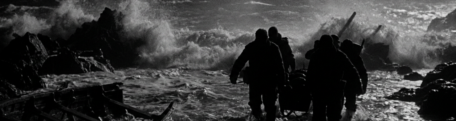
Archival evidence shows Task Group 34.8 depended on specialized electric transmitter masts aboard wooden scout craft to direct incoming landing waves toward Fedala Red and Blue beaches near 33 degrees 42 minutes north latitude. Heavy wave impacts destroyed that arrangement completely. Salt spray infiltrated the deck-mounted junction boxes. This burned out the six-volt rheostats and dead-grounded the masthead signal lamps. Landing craft from USS Leonard Wood and USS Joseph T. Dickman were already forming up five miles offshore. Boat commanders realized the primary optical guidance arrays were dead. Scout teams faced an immediate operational choice. They could abandon the guidance plan or put men directly into the water. Four-man scout details stripped down to canvas swim shorts and woolen sweaters. They strapped compasses, wire-cutters, and waterproofed illumination kits to their belts. Leaving their stalled craft behind in the outer swell, the swimmers went over the gunwales into fifty-eight-degree Atlantic water. Heavy four-knot undertow currents dragged them toward the breaker zone. Each man had to kick through six hundred yards of violent surf while swallowing salt water and sand.
Two scouts lost their buoyant equipment packs in the eight-foot breaker line.
A close review of operational logs indicates the surviving swimmers reached the intertidal zones of Red Beach and Blue Beach completely detached from offshore support craft. Kneeling in six inches of surging foam, the scouts pulled out brass TL-122 flashlights and hooded kerosene combat lanterns wrapped in vulcanized rubber sleeves. Operational doctrine prohibited fixed shore illuminators. The failure of seaward markers left no alternatives. The men dropped flat into the wet sand. They used their bodies to block light scatter toward French observation posts situated on the high coastal dunes fifty yards inland. Working through near-freezing shore winds, scouts turned the narrow five-inch lamp hoods seaward. They toggled red lenses for the northern limits of Beach Red Two and amber lenses for Beach Blue. French perimeter pickets from the 1st Moroccan Tirailleurs Regiment detected the light reflections off the wet sand at 0445. Machine gun crews opened fire with 7.5mm Chatellerault automatics. They walked bursts of solid-lead bullets inches above the water mark where the scouts lay pinned with their lights leveled at the open sea.
Tracers snapped through the wave crests directly above the prone signalmen.
When examining the historical record, those exposed light points gave Vichy coastal gunners immediate targeting coordinates for heavy fire. The coastal battery at Cape Fedala armed with four 75mm field pieces and the Pont Blondin battery mounting four 138.6mm naval rifles swung their traversals toward the waterlines of Red and Blue beaches at 0510. Gun crews had previously registered their weapons to cover the Fedala littoral with pre-calculated defensive fire grids. High-explosive 75mm rounds struck the low-tide flats fifty yards from the red lantern positions. This threw shrapnel and pulverized shell fragments across the intertidal zone. Airbursts from 138.6mm naval rifles detonated thirty feet overhead. The shockwaves cracked the glass lenses of two hooded lamps. This blew hot kerosene across the sand. The blast concussed the forward scouts. Fragments gouged the wet sand around their positions. The scouts held their handheld flashlights steady against the shore berm. They aimed colored beams seaward as the lead landing craft from the 7th Infantry Regiment hit the outer sandbars.
At 0522, an incoming 75mm high-explosive round detonated eighteen feet from the primary red marker stake. It threw sixty pounds of wet gravel across the prone signal team.
Assault Wave Confusion and Surf Zone Boat Losses
Archival evidence shows navigation unraveled across the open bay when the first assault waves of Major General Jonathan W. Anderson 3rd Infantry Division slipped their transport lines at 0400. Coxswains steering thirty-six-foot Higgins landing craft from USS Leonard Wood and USS Charles Carroll could not see the low shore markers through the heavy sea haze. Magnetic steering compasses mounted on the wooden engine boxes developed deviations of up to fifteen degrees. The dense cluster of steel M1 helmets, Springfield rifles, and ammunition boxes packed against the forward bulkheads threw off the magnetic readings. A persistent two-knot east-northeast littoral current swept the formations toward the rocky headlands. Wave commanders mistook the silhouetted cranes of the Fedala commercial port for the promontory at Cape Fedala. This led entire waves of the 7th Infantry Regiment to turn early. Over a dozen craft assigned to Beach Red Two wandered two miles east into the sector fronting the French defensive works at Pont Blondin. Other detachments beached blindly in the darkness three miles west near the rocky shoals of Mansouria.
Disorientation scattered the assault across seven miles of unreconnoitered coastline.
A close review of operational logs indicates the physical dynamics of the Fedala littoral destroyed the theoretical beaching schedules within the first hour of contact. Ten to fifteen foot swells built rapidly over the shallow outer sandbar two hundred yards offshore. Flat-bottomed Higgins boats throttled down to meet the shore gradient. Following seas lifted their square transoms. This robbed the unbalanced rudders of steerageway and slewed the hulls broadside to the breaking rollers. Wave crests crashed over the low wooden gunwales. This drowned the 225-horsepower Gray Marine diesel engines under tons of salt water and sand slurry. Successive breaker waves rolled the wooden craft and hammered them into the hard bottom. By midday on November 8, Task Group 34.8 had lost over fifty landing craft along the Fedala surf line. Splintered mahogany hull frames, sheared bronze drive shafts, and discarded equipment mats formed a continuous barrier of debris across Beaches Red and Blue. This blocked incoming waves and left follow-on echelons without navigable channels to the sand.
Plywood and iron wreckage choked the surf line three hulls deep.
When examining the historical record, this mechanical destruction forced surviving Navy Scouts and Raiders to abandon their primary doctrinal assignment as beach reconnaissance guides. They found their signaling stations flooded and offshore boat traffic descending into complete chaos. Scout personnel stripped off their boots, web gear, and uniforms to act as emergency surf salvors and rescue swimmers. Men plunged into fifty-eight-degree water with braided manila retrieval lines wrapped around their torsos. They fought a four-knot rip current to reach drowning soldiers thrown into deep scour holes by overturned craft. Scouts hauled waterlogged infantrymen out of the breaker zone by their pack straps. They cut away heavy canvas cartridge belts before the undertow pulled them down. Working under intermittent French 75mm shellfire, scout teams rigged snatch blocks to steel deadmen buried in the upper sand berm. They coupled salvage cables to broached hulls to winch them straight before the following breakers crushed their transoms.
Reconnaissance specialists became cold-water laborers.
Hand-to-hand recovery operations continued through the morning breakers. Personnel waded waist-deep to salvage cargo before the outgoing tide dragged flooded hulls into deep water. Teams hauled five-gallon fuel drums, water-sealed radio dry-packs, and crates of .30-caliber ammunition onto dry ground. They stacked the recovered gear behind sand berms forty yards from the waterline. By 0930, the scout detachment on Beach Red Two had manually dragged fourteen swamped LCVPs onto the shelf. They pulled twenty-eight soldiers of the 30th Infantry Regiment from the outer scour trough.
Post-Operation Torch Doctrine and Future Amphibious Training
Prewar doctrine failed completely along the Moroccan reefs.
Archival evidence shows Rear Admiral H. Kent Hewitt after-action reports forced the Navy Department to confront severe doctrinal omissions inside Fleet Training Publication 167. Theoretical diagrams in the prewar text had treated the coastal interface as a static, flat highway. Over fifty landing craft lay shattered across the Fedala surf line because doctrine failed to calculate open-ocean wave physics. Planners in Washington had relied on peacetime assumptions of three-foot gentle swells. This left boat crews defenseless against sixteen-foot Atlantic groundswells. Naval leadership ordered a comprehensive revision of FTP 167. They discarded arbitrary clockwork assault schedules in favor of empirical wave mechanics. To solve the surf problem, the Bureau of Ships and the Navy Hydrographic Office contracted oceanographers Harald Sverdrup and Walter Munk at the Scripps Institution of Oceanography. Sverdrup and Munk developed mathematical forecasting equations to predict swell travel, wave periods, and nearshore breaker heights from offshore wind speeds across thousands of miles of ocean. Revised editions of the manual integrated these empirical wave-refraction charts. This required assault planners to compute breaker angles and surf-zone energy dissipation before committing wooden hulls to the beach. Updated fleet procedures also mandated dedicated surf salvage units equipped with tracked tractor winches and heavy recovery cables. These units would pull broached craft off the sand before following waves smashed their keels.
Mathematical hydrography replaced arbitrary assault schedules.
A close review of operational logs indicates the Scout and Raider training organization underwent rapid structural changes. They shifted from the calm shallows of Little Creek to Amphibious Training Base Fort Pierce in January 1943. Instructors, including Fedala veteran Lieutenant Phil H. Bucklew, integrated systematic hydrographic surveying and obstacle reconnaissance directly into the advanced curriculum. Trainees logged exhausting night evolutions in the heavy Atlantic surf along North Hutchinson Island. They used fourteen-pound lead lines and marked sounding poles to measure beach gradients at ten-yard intervals. Working beneath lightproof canvas shelters, scout pairs plotted raw sounding depths onto waterproof charts using grease pencils. They identified offshore troughs and scouring backwash that had drowned soldiers in Morocco. Advanced training required scouts to swim through eight-foot breaker zones with waterproofed magnetic compasses and mechanical stopwatches. They calculated littoral drift while charting submerged sandbars, rock outcrops, and rip channels. Instructional guidelines forced teams to locate underwater drop-offs and map unobstructed boat channels from rubber reconnaissance craft four hundred yards off simulated enemy gun batteries. They converted rough surf into mapped approach lanes.
Beach scouting alone could not blast open fortified channels.
When examining the historical record, the mechanical destruction at Fedala demonstrated scout crews could not dismantle heavy beach obstructions while guiding landing craft under fire. Naval planners recognized assaults against fortified coastlines in Europe demanded specialized combat engineers operating directly inside the breaker line. In May 1943, Chief of Naval Operations Admiral Ernest J. King directed Lieutenant Commander Draper L. Kauffman to establish the Naval Combat Demolition Unit training school at Fort Pierce. Kauffman selected volunteers from Navy Construction Battalions at Camp Peary and the Bomb Disposal School in Washington. He organized them into six-man teams of one officer and five enlisted men. Instruction focused on handling twenty-pound packs of tetrytol, shaped charges, and waterproofed primacord networks. They learned to sever steel rail obstacles, Belgian gates, and concrete tetrahedrons. Trainees endured an intense eight-day physical trial designated Hell Week. They hauled heavy explosives through pounding breakers in small LCRS rubber boats. Severe sleep deprivation and hypothermia set in. By the spring of 1944, thirty-four qualified Naval Combat Demolition Units departed Fort Pierce for England. They were assigned to clear experimental breach lanes across the Normandy invasion beaches.